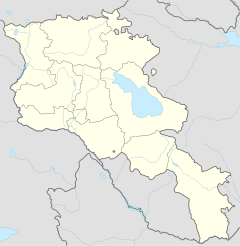
Dastakert
|
Dastakert Դաստակերտ |
||
| State : |
|
|
| Province : | Sjunik | |
| Founded : | 12-13 Century | |
| Coordinates : | 39 ° 23 ' N , 46 ° 2' E | |
| Height : | 2050 m | |
| Area : | 1.026 km² | |
| Residents : | 301 (2009) | |
| Population density : | 293 inhabitants per km² | |
| Time zone : | UTC + 4 | |
| Postal code : | 3509 | |
| Community type: | Village | |
|
|
||
Dastakert ( Armenian Դաստակերտ ) is a village in the Armenian province of Sjunik (historically Sangesur ), which until 2017 had city status as a so-called urban-type settlement . With only 301 inhabitants (calculation 2009) it was considered to be the smallest city in Armenia until then.
geography
The city is located in the west of the province, not far from the border with the Azerbaijani Autonomous Republic of Nakhichevan . The village, located at around 2000 m , is surrounded by the 3000 m high eastern side ridges of the Sangesurkamm. Dastakert is located on the upper reaches of the Ajriget river, which flows into the Tolors reservoir of the Sissian. The Sissian opens a little later, lying north at 15 km crow flies from Dastakert city of the same Sissian in the Vorotan .
history
The Armenian historian Stepanos Orbeljan († 1304) mentions the place for the first time for the 12th to 13th centuries, when it belonged to the province of Zghuk of the Sjunik State, which was an independent kingdom from 970 to the conquest by the Seljuks in 1170 and under the Mongol rule from 1251 was relatively autonomous. The village was called Dastakern or Dastakjurd at this time .
1951 Dastakert received in connection with the construction of a copper - molybdenum - mine with associated Erzaufbereitungsfabrik the status of an urban-type settlement . Production started in 1952. However, after a brief period of prosperity, mining experienced a rapid decline, and the population fell from 2,317 (1959) to 1,308 (1970) to just 326 in 1989. During the economic crisis in the years of the collapse of the Soviet Union after 1990, the Sangesurer suffered Copper and molybdenum combine bankrupt plant .
Although the population stabilized at the low level of 1989, Datakert received city rights in 1995.
Attractions
Two kilometers to the north there is a rock with ancient inscriptions, called the Wardapet stone , and in the northeastern part of the city there is an old tomb.
Economy and Infrastructure
The only larger company, a copper-molybdenum mine in the valley above the town with an ore enrichment factory, ceased operations in the early 1990s.
Dastakert is connected to Sissian via the regional road H44 and the Yerevan - Meghri highway, which passes six kilometers beyond Sissian . About this Dastakert is 236 kilometers from the state capital Yerevan and 115 kilometers from the provincial capital Kapan .
See also
Web links
Individual evidence
- ↑ https://armeniadiscovery.com/en/city/dastakert (accessed January 4, 2020)
- ↑ Syunik marz in Marzes of the Republic of Armenia in figures, 2004-2008 of the National Statistical Service of the Republic of Armenia (English, Armenian; PDF; 277 kB)
- ↑ Article Kingdom of Sjunik in the Great Soviet Encyclopedia (BSE) , 3rd edition 1969–1978 (Russian)
