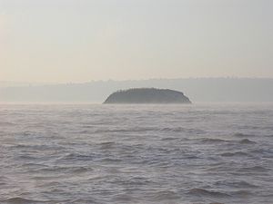
Denny Island (Monmouthshire)
| Denny Island | ||
|---|---|---|
| Denny Island as seen from Portishead | ||
| Waters | Severn / Bristol Channel | |
| Geographical location | 51 ° 31 '32 " N , 2 ° 46' 54" W | |
|
|
||
| length | 350 m | |
| width | 130 m | |
| surface | 0.24 ha | |
| Residents | uninhabited | |
Denny Island is an island in the Severn Estuary . The island is part of Monmouthshire in Wales . The southern end of the bushy rock island is the border between Wales and England and forms the north-western border of the city of Bristol in the Severn.
The island is about 4.5 km north of Portishead and thus halfway between Redwick in Wales and Avonmouth in England. The Welsh Grounds sandbar surrounds the island, the surroundings of which are greatly altered by the tides. The tidal range in the Bristol Channel and the Severn estuary is among the highest in the world at up to 13.7 m. Seagulls , cormorants and other sea birds nest on the island.
The island lies in the Denny Island Fracture Zone , which is part of the Avon-Solent Fracture Zone .
history
Denny Island is first mentioned as Dunye in 1373 in the Bristol County Charter. This suggests that the name comes from the Old English language and means 'island in the shape of a round hill'.
In 2004, the application to remove the island from a map directory of public land in accordance with the Countryside and Rights of Way Act 2000 failed .
In January 2012, two men spent five days on the island, sitting most of the time under their upturned dinghy to attract attention and raise money for a primary school and children's hospice.
Individual evidence
- ↑ Bristol City Council - Beating Bristol's water boundary ( Memento of the original from October 12, 2007 in the Internet Archive ) Info: The archive link was automatically inserted and not yet checked. Please check the original and archive link according to the instructions and then remove this notice.
- ^ GA Kellaway: Discovery of the Avon-Solent Fracture Zone and its relationship to Bath hot springs. . In: Environmental Geology . 28, No. 1, 1996, pp. 34-9. doi : 10.1007 / s002540050076 .
- ^ N. Dermott Harding: Bristol charters, 1155-1373 p 154-5 . Bristol Record Society, 1930.
- ↑ Appeal Decision (PDF) Planning Inspectorate ,. November 2004. Retrieved May 21, 2007.
- ↑ Island campers brave elements ( page no longer available , search in web archives ) Info: The link was automatically marked as defective. Please check the link according to the instructions and then remove this notice. In: Bristol Post, January 10, 2012, accessed June 16, 2014

