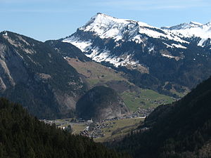
Diedamskopf
| Diedamskopf | ||
|---|---|---|
|
Diedamskopf over Au |
||
| height | 2090 m above sea level A. | |
| location | Vorarlberg , Austria | |
| Mountains | Northwestern Walsertal Mountains , Allgäu Alps | |
| Dominance | 5.4 km → Üntschenspitze | |
| Notch height | 290 m ↓ Diedsattel | |
| Coordinates | 47 ° 20 '47 " N , 10 ° 1' 32" E | |
|
|
||
| rock | Helvetic | |
| Age of the rock | chalk | |
The Diedamskopf is the local mountain of Schoppernau in the Austrian state of Vorarlberg . It is 2,090 meters high.
Location and surroundings
The Diedamskopf is surrounded to the northeast by the Hohen Ifen (2230 m) and to the southeast by the Üntschenspitze (2135 m). In the southwest are Schoppernau and the valley of the Bregenzer Ach and thus the Bregenzerwald region . The Hirschberg (1834 m) rises to the west .
According to the Alpine Club division of the Eastern Alps , the Diedamskopf belongs to the Allgäu Alps , on whose western edge it is located.
Ascent
The Diedamskopf is a popular destination for locals and tourists. The ascent from the valley of the Bregenzer Ach requires a lot of stamina, but is completely easy ( T1 ). The walking time from Schoppernau is three to four hours. From the Diedamskopf mountain station there is still 70 meters in altitude to the summit.
Cable car and ski area
The Diedamskopf cable car leads from Schoppernau continuously with an intermediate station up the mountain, in the mountain station there is a panorama restaurant. The Wälderbus 40 drives to the valley station.
A study on the feasibility of a World Cup course was carried out for the Diedamskopf in 2003 .
Holdamoos Au-Schoppernau
The Holdamoos nature experience shows 400 years of alpine history. In the middle of the cultural and natural landscape there is a mountain hut in its original state, a suspension bridge , a small lake, a Kneipp facility and a herb garden with over 150 different herbs, which is looked after by Anne Maria Bär and 14 women from Au and Schoppernau. The Holdamoos can be reached from the car park at the Diedamskopf valley station or from Au-Rehmen; the hiking time is estimated at two and a half hours.
photos
Web links
Individual evidence
- ^ Herbert Scholz: Building and Becoming the Allgäu Landscape . E. Schweizerbart'sche Verlagsbuchhandlung (Nägele and Obermiller), Stuttgart 1995, ISBN 3-510-65165-0 (pp. 92, 122).
- ↑ Long slalom to the descent . Article on Vorarlberg Online of January 22, 2008. Accessed on January 16, 2010.


