Dmytrivka (Snamyanka)
| Dmytrivka (Snamyanka) | ||
| Дмитрівка | ||

|
|
|
| Basic data | ||
|---|---|---|
| Oblast : | Kirovohrad Oblast | |
| Rajon : | Znamyanka district | |
| Height : | 121 m | |
| Area : | 13.674 km² | |
| Residents : | 4,250 (2004) | |
| Population density : | 311 inhabitants per km² | |
| Postcodes : | 27424 | |
| Area code : | +380 5233 | |
| Geographic location : | 48 ° 48 ' N , 32 ° 43' E | |
| KOATUU : | 3522281501 | |
| Administrative structure : | 6 villages | |
| Address: | пл. Перемоги 4 27422 с. Дмитрівка |
|
| Website : | City council website | |
| Statistical information | ||
|
|
||
Dmytriwka ( Ukrainian Дмитрівка ; Russian Дмитровка Dmitrowka ) is a village in the northeast of the Ukrainian Oblast Kirovohrad with about 4200 inhabitants (2004).
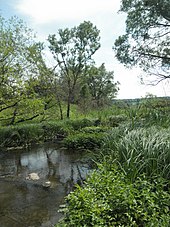
The village, founded in the 1730s, lies on the banks of the Inhulez and is the administrative center of a district council within the Znamyanka district . Dmytrivka is located about 50 km northeast of the Oblast capital Kropywnyzkyj and 11 km north of the district center Znamyanka . Territorial road T-12-11 runs through Dmytriwka . The Botschky ( Бочки ) nature reserve is located near the village .
The villages also belong to the district council:
- Wesselyj ( Веселий ⊙ ) with about 300 inhabitants,
- Hostynne ( Гостинне ⊙ ) with about 300 inhabitants,
- Dolyna ( Долина ⊙ ) with about 40 inhabitants,
- Kalyniwka ( Калинівка ⊙ ) with about 60 inhabitants,
- Ploske ( Плоске ⊙ ) with about 370 inhabitants.
Individual evidence
- ↑ The village's website on the Verkhovna Rada website , accessed on June 22, 2015 (Ukrainian)
- ^ Local history of Dmytrivka in the history of the cities and villages of the Ukrainian SSR ; accessed on October 29, 2019 (Ukrainian)


