Doornspijk
 flag |
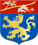
 coat of arms |
| province |
|
| local community |
|
|
Area - land - water |
19.93 km 2 19.93 km 2 0 km 2 |
| Residents | 3,285 (Jan. 1, 2017) |
| Coordinates | 52 ° 25 ' N , 5 ° 49' E |
| Important traffic route |
|
| prefix | 0525 |
| Postcodes | 8071-8072, 8081, 8084-8085 |
| Location of Doornspijk in the municipality of Elburg | |
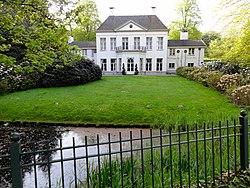
| Klarenbeek Manor ( Rijksmonument ) | |
Doornspijk is a village and a formerly independent municipality in the Dutch province of Gelderland . The name "Thornspiic" was mentioned in a document as early as 796; the neighboring town of Elburg originally had the same name. In 1974 most of the municipality of Doornspijk was incorporated into Elburg. Smaller areas were added to the neighboring communities of Nunspeet and Oldebroek . In 2009 the village of Doornspijk had 1,490 inhabitants; For 2017, the Dutch state statistical office CBS reports 3,285 inhabitants for the village including the associated district area.
Web links
Commons : Doornspijk - collection of images, videos and audio files
Individual evidence
- ↑ a b Kerncijfers wijken en buurten 2017 Centraal Bureau voor de Statistiek , accessed on July 9, 2018 (Dutch)
- ↑ Repertory of the Dutch Congregations 1812–2011 (PDF; 8.9 MB)


