Drahowo
| Drahowo | ||
| Драгово | ||

|
|
|
| Basic data | ||
|---|---|---|
| Oblast : | Zakarpattia Oblast | |
| Rajon : | Khust district | |
| Height : | 369 m | |
| Area : | Information is missing | |
| Residents : | 4,450 (2004) | |
| Postcodes : | 90432 | |
| Area code : | +380 3142 | |
| Geographic location : | 48 ° 14 ' N , 23 ° 33' E | |
| KOATUU : | 2125382801 | |
| Administrative structure : | 4 villages | |
| Address: | вул. Центральна 100 90432 с. Драгово |
|
| Statistical information | ||
|
|
||
Drahowo ( Ukrainian Драгово ; Russian Драгово Dragowo , Slovak Drahovo , Hungarian Kövesliget ) is a village in the Ukrainian Zakarpattia Oblast with 4450 inhabitants (2004).

In the village there is a mineral fountain that fills Drahiwska ( Драгівська ) mineral water.
Geographical location
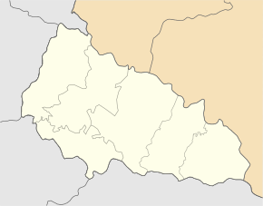
Drahovo is on 369 m height on the banks of Tereblya and the territorial road T-07-20 . The Khust district center is 28 km southwest and the Uzhhorod oblast center is 134 km northwest of the village.
local community
The village is the administrative center of the homonymous, 27.64 km² district council with about 6600 inhabitants in the east of Khust district , to which the villages Kitscherely ( Кічерели ⊙ ) with about 940 inhabitants, Saberesch ( Забереж ⊙ , until 2016 Shovtnewe ) with about 720 inhabitants and Stanowez ( Становець ⊙ ) with about 480 inhabitants.
history
Until 1919, the village in the historical Maramureş region belonged to the Hungarian part of the Austro-Hungarian Empire and then as part of the Carpathian-Ukraine to Czechoslovakia . It was annexed to Hungary between 1939 and 1945. In 1945 the village became part of the Ukrainian SSR within the Soviet Union and since 1991 Drahowo has belonged to the independent Ukraine.
Individual evidence
- ^ Village website on the Verkhovna Rada official website ; accessed on April 22, 2017 (Ukrainian)
- ↑ mineral Drahiwska ; accessed on April 22, 2017 (Ukrainian)
- ^ Website of the district council on the official website of the Verkhovna Rada ; accessed on April 22, 2017 (Ukrainian)

