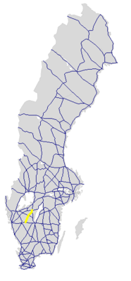
Riksväg 46
| Riksväg 46 in Sweden | |
| 46 | |
| map | |
| Basic data | |
| Operator: | |
| Overall length: | 69 km |
|
Length : |
|
| The street and the water tower in Stenstorp | |
The Riksväg 46 is a Swedish highway in County Västra Götaland .
course
The road leads from Ulricehamn , where it branches off from Riksväg 40 to the north, via Falköping , where Riksväg 47 crosses and Länsväg 184 branches off to Skara , via Stenstorp to the confluence with Riksväg 26 around 11 km south of Skövde .
The length of the road is around 69 km.
history
The street has had its current number since 1962.
Individual evidence
- ↑ Sverige vägatlas 2014, Norstedts, Stockholm. ISBN 978-91-1305683-8
Web links
Commons : Riksväg 46 - Collection of images, videos and audio files

