Riksväg 66
| Riksväg 66 in Sweden | |
| 66 | |
| map | |
| Basic data | |
| Operator: | |
| Overall length: | 258 km |
|
Length : |
|
| The road north of Västerås (2013) | |
The Riksväg 66 is a Swedish highway in County Västmanland and Dalarna .
course
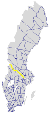
The road branches off from Europaväg 18 in Västerås and runs northwest via Fagersta , where it crosses Riksväg 68 , Ludvika , where Riksväg 50 is crossed, and Björbo , where it meets Europaväg 16 , with which it crosses Vansbro , where the Riksväg 26 is crossed, to Malung . This is where the common course ends with the Europaväg 16, which turns to the southwest together with the Europaväg 45 . Riksväg 66 continues north-north-west following Västerdalälven up to Dälen , where it leaves the river and continues to the west-north-west to the Swedish-Norwegian border in Bergulvkjølen near Støa in Norway . The continuation on the Norwegian side is the Riksvei 25 .
The length of the road is around 258 km without the common course with Europaväg 16.
history
The street has had its name since 1992. Before that, it was number 65, which was given up in favor of the Swedish part of the European route 65 .
Individual evidence
- ↑ Sverige vägatlas 2014, Norstedts, Stockholm. ISBN 978-91-1305683-8


