Riksväg 56
| Riksväg 56 in Sweden | |
| 56 | |
| map | |
| Basic data | |
| Operator: | |
| Overall length: | 295 km |
|
Length : |
|
| The street in Sala | |
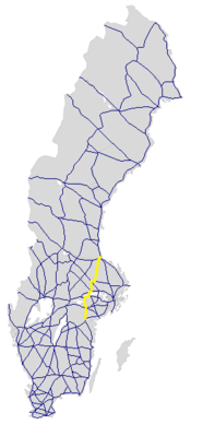
The Riksväg 56 is a Swedish trunk road ( nationally stamväg ) in Östergötland , Södermanland , Västmanland , Uppsala and Gävleborgs .
course
The road, also known as Räta linjen , leads from Norrköping , where it branches off together with Riksväg 55 to the north from Europaväg 4 , via Katrineholm (here separation from Riksväg 55) and on over the Hjälmare- Sound and Alberga (with the branch of Länsväg 230 ) according to Arboga . From there it runs over 31 km together with Europaväg 20 to the east and leaves it again in Tumbo, west of Eskilstuna . From there, it continues its path across the Strait between the lakes Mälaren and Galten at Kvicksund continued achieved at Dingtuna the Europaväg 18 and runs together with this by Västerås . There it separates again from the European route and leads north to Sala . There she crosses Riksväg 70 . Its continuation leads together with the Riksväg 72 east to Heby and from there further north past Tärnsjö and Hedesunda to Valbo west of Gävle , where it meets the Europaväg 16 and ends there.
The length of the road is around 295 km, of which 47 km together with Riksväg 55, 31 km together with Europaväg 20, 16 km together with Europaväg 20 and 15 km together with Riksväg 72.
history
The street has had its current name for its full length since 2007.
Individual evidence
- ↑ Sverige vägatlas 2014, Norstedts, Stockholm. ISBN 978-91-1305683-8


