Riksväg 26
| Riksväg 26 in Sweden | |
| 26th | |
| map | |
| Basic data | |
| Operator: | |
| Overall length: | 580 km |
|
Length : |
|
| Junction of Länsväg 245 near Tyfors (2009) | |
The Riksväg 26 is a Swedish highway in County Halland , Jönköping County , Västra Götaland County , Värmland County and Dalarna .
course
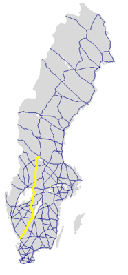
The road begins in Halmstad at the motorway-like Europaväg 6 (also Europaväg 20 ) and runs in a north-easterly direction via Hyltebruk , Smålandsstenar and Gislaved , where it crosses Riksväg 27 , to Riksväg 40 , with which it leads to Jönköping , from there to the north-west turns and together with the Riksväg 47 reaches Mullsjö . From there, it extends further in a northerly direction, separates after 14 km from Riksväg 47, crosses the Swedish county road 193 at Tidaholm takes south of Skövde the Riksväg 46 and crosses the in Skövde Riksväg 49 . At Mariestad it runs over 12 km together with Europaväg 20. It then follows the east bank of Vänern to Kristinehamn , where it crosses Europaväg 18 . In Storfors it takes up Länsväg 237 . From Filipstad it runs for 10 km together with Riksväg 63 . In the further course it reaches the historical landscape of Dalarna and crosses the Europaväg 16 in Vansbro . Finally, they reached the southern end of the lake Venjansjön the Europaväg 45 and runs along with this by Mora Lake Siljan , where it ends.
The length of the road officially designated as a trunk road (stamväg) is around 580 km. This makes it the longest Reichsstrasse that is not also designated as a European route .
history
The street has had the current number over its full length since 2006.
Individual evidence
- ↑ Sverige vägatlas 2014, Norstedts, Stockholm. ISBN 978-91-1305683-8


