Riksväg 62
| Riksväg 62 in Sweden | |
| 62 | |
| map | |
| Basic data | |
| Operator: | |
| Overall length: | 235 km |
|
Length : |
|
| Shop on the street at Edeback | |
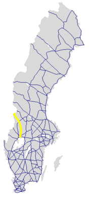
The Riksväg 62 is a Swedish highway in County of Värmland .
course
The road, which largely follows the course of the Klarälven River , branches off from Europaväg 18 in Karlstad and runs north via Forshaga and Munkfors , where Länsväg 241 branches off to the west, Råda (branch of Länsväg 245 to the east), Ekshärad (branch of Länsväg 239 to the west) and Stöllet (crossing with Europaväg 45 and Europaväg 16 ) and Sysslebäck to the Swedish-Norwegian border at Höljessjön with the Höljes power station . In Norway it is continued at Riksvei 26 .
The length of the road is around 235 km.
Individual evidence
- ↑ Sverige vägatlas 2014, Norstedts, Stockholm. ISBN 978-91-1305683-8
Web links
Commons : Riksväg 62 - collection of images, videos and audio files

