Riksväg 99
| Riksväg 99 in Sweden | |
| 99 | |
| map | |
| Basic data | |
| Operator: | |
| Overall length: | 360 km |
|
Length : |
|
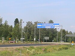
| The street in Haparanda | |
The Riksväg 99 is a Swedish highway in County Norrbotten .
course
The road runs largely north of the Arctic Circle from Europaväg 4 in the border city Haparanda at the northernmost point of the Baltic Sea substantially parallel to the right bank of the river Torne älv about Övertorneå according Pajala and in their northern section parallel to älv Muonio that the border to Finland form, according to Karesuando , where it meets and ends at Europaväg 45 ( Inlandsvägen ). On the Finnish side, on the left bank of the two rivers, Europastraße 8 ( State Road 21 ) runs essentially parallel. The length of the road is 360 km.
history
Along the Torne älv there was a road to Svanstein as early as the 18th century . The road has been called Riksväg 99 as far as Övertorneå since 1962, and on the remaining section since 2000.
Individual evidence
- ↑ Sverige vägatlas 2014, Norstedts, Stockholm. ISBN 978-91-1305683-8

