
Juoksengi
| Juoksengi | ||||||
|
||||||
| State : | Sweden | |||||
| Province (län): | Norrbotten County | |||||
| Historical Province (landskap): | Norrbotten | |||||
| Municipality : | Övertorneå | |||||
| Coordinates : | 66 ° 34 ′ N , 23 ° 51 ′ E | |||||
| SCB code : | 8640 | |||||
| Status: | Crime scene | |||||
| Residents : | 327 (December 31, 2015) | |||||
| Area : | 1.51 km² | |||||
| Population density : | 217 inhabitants / km² | |||||
| List of perpetrators in Norrbotten County | ||||||

Juoksengi is a place ( Tatort ) in the Swedish province of Norrbotten County and in the historical province of Norrbotten .
location
Juoksengi belongs to the municipality of Övertorneå . The place is about 130 km as the crow flies northeast of the provincial capital Luleå and a good 20 km northeast of the main town of the municipality, Övertorneå , on the right bank of the Torne älv , which marks the border with Finland there . Juoksengi is the second largest town in the municipality after Övertorneå.
Juoksengi is located exactly on the Arctic Circle . Riksväg 99, which runs from Haparanda along the Torne älv and the Finnish border to Karesuando, runs through the village . The Polcirkelhuset was opened in 2004 at the level of the crossing of the Arctic Circle at the southern entrance to the town . A few kilometers south of the village there is another rest area with a restaurant and information center on the road at the level of the Kattilakoski des Torne älv rapids .
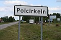
Arctic Circle in Juoksengi

Street decoration with the inscription Polarkreisdorf Juoksengi
.jpg)

history
Juoksengi is one of the oldest villages in Tornedalen and already existed in the late Middle Ages . In the 16th century there were around 15 farms. The meaning of the place name, initially mentioned as Jwxenge , Joxenge and Juxenhe , has not been clearly clarified: either from the Sami word juoksa for 'arch' - based on the course of the Torne älv south of the village - or, more likely, from a personal name Juoksa . In 1760 the name Juoxengi, which is similar to today's, appears for the first time .
The village lay on both sides of the Torne älv, but was separated in 1809 when Finland was annexed to the Russian Empire and the Torne älv became the state border. Since then, the districts have developed separately; the village on the Finnish side is now part of the municipality of Pello as Juoksenki .
Since the middle of the 20th century, the population of Juoksengi has decreased by more than half. The place is dominated by agriculture; there are also various transport and craft companies. In the village there is a church, consecrated in 1963 and expanded in 1984, as well as a school.
Individual evidence
- ↑ a b Statistiska centralbyrån : Land area per Tatort, folkmängd and invånare per square kilometer. Vart femte år 1960 - 2015 (database query)
Web links
- Website of the place (Swedish)
Perpetrator: Hedenäset | Juoksengi | Övertorneå
Småorter: Aapua | Haapakylä | Kuivakangas | Neist kangas | Niemis | Pello | Poikijärvi | Pudas | Rantajärvi | Soukolojärvi | Svanstein | Vitsaniemi