Dreisbach (Bröl)
| Dreisbach | ||
|
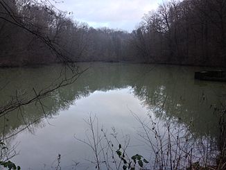
Dreisbach, dammed near Neunkirchen |
||
| Data | ||
| Water code | DE : 272676 | |
| location | North Rhine-Westphalia , Germany | |
| River system | Rhine | |
| Drain over | Bröl → Sieg → Rhine → North Sea | |
| source | At Eischeid 50 ° 50 ′ 51 ″ N , 7 ° 21 ′ 39 ″ E |
|
| Source height | approx. 217 m above sea level NHN | |
| muzzle | In Ingersau in the Bröl coordinates: 50 ° 49 ′ 18 ″ N , 7 ° 21 ′ 19 ″ E 50 ° 49 ′ 18 ″ N , 7 ° 21 ′ 19 ″ E |
|
| Mouth height | approx. 97 m above sea level NHN | |
| Height difference | approx. 120 m | |
| Bottom slope | approx. 27 ‰ | |
| length | 4.4 km | |
| Catchment area | 5.418 km² | |
| Right tributaries | Ohlenhohnsbach, Jahlssiefen, Bonnenbach, Pfeifersbach | |
|
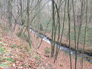
Dreisbach, viewing direction: south |
||
The Dreisbach is a 4.4 km long orographically right tributary of the Bröl in North Rhine-Westphalia , Germany . The stream rises in the north of the village of Eischeid at an altitude of 218 m above sea level. NHN and flows over Neunkirchen , Hohn and flows into Ingersau at 108 m above sea level. NHN on the right in the Bröl. On its way, the stream experiences a gradient of 110 m, which corresponds to a mean bed gradient of 25 ‰. The Dreisbach drains a catchment area of 5.418 km².
In the lower reaches of the B 507 leads through the Dreisbachtal.
Web links
- 272138 Dreisbach , water network NRW
Individual evidence
- ↑ a b German basic map 1: 5,000
- ↑ a b Water directory of the State Office for Nature, Environment and Consumer Protection NRW 2010 (XLS; 4.67 MB) ( Notes )
- ↑ Topographical Information Management, Cologne District Government, Department GEObasis NRW ( Notes )

