Drygalski ice tongue
| Drygalski ice tongue | ||
|---|---|---|
|
Collision of Iceberg C-16 with the Drygalski Ice Tongue in March 2006 |
||
| location | Victoria Land , East Antarctica | |
| length | 48 km | |
| Coordinates | 75 ° 24 ′ S , 163 ° 30 ′ E | |
|
|
||
| drainage | McMurdo Sound | |
|
Edge of the Drygalski ice tongue |
||
|
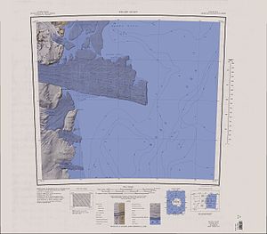
Topographic map sheet 1: 250,000 |
||
The Drygalski Ice Tongue (also Drygalski Barrier or Drygalski Glacier Tongue ) is a glacier tongue in Antarctica that flows into McMurdo Sound as an extension of the David Glacier on the Scott Coast in the east of Viktorialand . The ice tongue has a north-south extension of 14 to 24 km and a length of more than 48 km. The age of the ice is estimated to be up to 4,000 years.
The ice tongue was discovered in January 1902 as part of the Discovery Expedition (1901–1904) by the British polar explorer Robert Falcon Scott , who named it after the German polar explorer Erich von Drygalski (1865–1949), who at the same time carried out the Gauß expedition to Kaiser- Wilhelm-II.-Land headed. There is a risk of confusion with the Drygalski Glacier on the east coast of the Antarctic Graham Land .
In May 2005, after the collision of iceberg B-15 A, two approximately 70 km² plates broke off the Drygalski ice tongue. With the C-16, which also came from the Ross Ice Shelf , another iceberg hit the glacier tongue at the end of March 2006, and a fragment of more than 100 km² was cut off from it.
Web links
- Drygalski Ice Tongue in the Geographic Names Information System of the United States Geological Survey (English)
- Drygalski Ice Tongue on geographic.org (English)
- Drygalski Ice Tongue. In: Kenneth J. Bertrand and Fred G. Alberts, Geographic names of Antarctica , US Govt. Print. Off., Washington 1956, p. 111 (English)


