Dworshak Dam
| Dworshak Dam | |||||||||
|---|---|---|---|---|---|---|---|---|---|
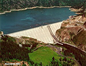
| Dam from the south-southwest, south side of the North Fork Clearwater | |||||||||
|
|||||||||
|
|
|||||||||
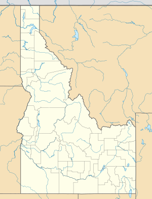
| Coordinates | 46 ° 30 '53 " N , 116 ° 17' 48" W | ||||||||
| Data on the structure | |||||||||
| Construction time: | 1966-1972 | ||||||||
| Height above foundation level : | 218.5 m | ||||||||
| Height of the structure crown: | 491.5 m | ||||||||
| Crown length: | 1 002 m | ||||||||
| Power plant output: | 380 MW | ||||||||
| Data on the reservoir | |||||||||
| Altitude (at congestion destination ) | 482 m | ||||||||
| Water surface | 80.2 km² | ||||||||
| Storage space | 4259 million m³ | ||||||||
| Dworshak Dam, viewed east from the north bank of the North Fork of the Clearwater River | |||||||||
| View towards Northeast to the dam, the North Fork of the Clearwater River upstream | |||||||||
The Dworshak Dam is a large dam in the northwestern United States. Located on the North Fork Clearwater River 6 km northwest of Orofino and 76 km east of Lewiston in Clearwater County , Idaho , it is used for hydropower generation and flood control . The dam was originally named "Bruces Eddy", but it was renamed in honor of US Senator Henry Dworshak from Idaho.
History and construction
The barrier structure is a concrete gravity dam . The dam is the tallest straight gravity dam in the western world. This record comes about because the higher Grande Dixence dam is kinked in plan. The Dworshak Dam is also the third highest dam in the US and is currently around 27th worldwide. In the US, only the Oroville Dam and the Hoover Dam are higher, plus the Cypus Dam, which is the dam of one Settling basin is. The Dworshak dam contains twice as much concrete as there would be room in the Great Pyramid in Egypt. The construction cost was $ 312 million.
The US Army Corps of Engineers began construction in June 1966. The main work was completed in 1972. The generators went into operation in 1973. The hydropower plant has three turbines , two with 90 MW and one with 220 MW, a total of 380 MW. Other sources speak of a total output of 400 MW. The overload capacity is 460 MW. The original plan was to install three more large turbines with 220 MW. Sockets for this were already provided, but these plans were abandoned in the 1990s. The dam only uses half the capacity that would be possible. The reason for this is the amount of water that would have to flow off below the dam. Therefore, a compensatory second dam would be necessary, but this was not approved due to public protests.
There are two flood relief locks and two water channels lying next to each other roughly in the middle of the dam.
Dworshak Reservoir
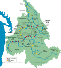
The Dworshak Dam, like the Grand Coulee Dam , is part of the Columbia River dam system . The reservoir is called "Dworshak Reservoir". It stretches 85 kilometers upstream to the Bitterroot Mountains. The north arm of the Clearwater River flows three kilometers below the dam with the south arm of the Clearwater and forms the Clearwater River , which joins the Snake River at Lewiston . The reservoir is also used for rafting wood.
See also
Web links
- Dworshak Dam @ US Army Corps of Engineers
- Dworshak Dam
- Dworshak Dam
- Aliensview sightseeing satellite image
- Dworshak Dam. In: Structurae


