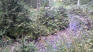
Ecker Bach
| Ecker Bach | ||
|
Ecker Bach (811 m) |
||
| Data | ||
| location | Upper Bavaria | |
| River system | Danube | |
| Drain over | Fehnbach → Schlierach → Mangfall → Inn → Danube → Black Sea | |
| Source height | 834 m | |
| muzzle |
Fehnbach coordinates: 47 ° 45 '11 " N , 11 ° 48' 37" O 47 ° 45 '11 " N , 11 ° 48' 37" O |
|
| Mouth height | approx. 754 m | |
| Height difference | approx. 80 m | |
| Bottom slope | approx. 27 ‰ | |
| length | approx. 3 km | |
| Left tributaries | Eder Bach | |
The Eckersbach and Gschwendtner Bach form the after their confluence Fehnbach , a left flow to Schlierach in Upper Bavaria .
The Ecker Bach in turn forms from the confluence of the Kothalpenbach and Gereuthbächlein south of the Wallenburger Kogel on the northern slopes of the Auer Mountain . The brook curves around the west side of the Wallenburger Kogel and then flows further east.
Web links
- [1] Course of the Ecker Bach on the BayernAtlas
