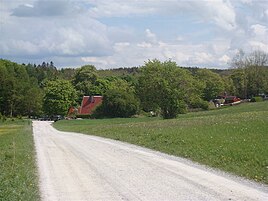
Eggeröder fountain
|
Eggeröder fountain
City of Oberharz am Brocken
Coordinates: 51 ° 46 ′ 59 ″ N , 10 ° 51 ′ 28 ″ E
|
|
|---|---|
| Height : | approx. 475 m |
| Postal code : | 38875 |
| Area code : | 039454 |
The forest settlement Eggeröder Brunnen is a district of Elbingerode (Harz) , which belongs to the town of Oberharz am Brocken . The settlement lies in the area of a desert and the source that gives it its name. Today the place is a holiday home area, with some accommodation facilities located on the site of a former holiday camp .
Desert and settlement
At the source area there used to be a place documented by King Otto I in 956 as Egininkisrod in which the place was assigned to the Michaeliskirche at the Volkmarskeller and thus given to Quedlinburg. This already existed since 9/10. Century. In the Middle Ages the place was called Engerode , an important ironworks place . After the mining phase ended, the place fell desolate .
In 1152 Egininkisrod became an economic yard of the Michaelstein monastery and is proven in 1173 as Dominicale Engerode as an accessory of the monastery. The next written record comes from the year 1311, as the curia of the monastery. The exact time is unknown. From the year 1733 the place is already desolate and only referred to as Engeröder Born on a Hüttenroder land map . The nearby forester's house, which is probably still in the desert area, is proven from 1820 by a geometrical floor plan of the Heimburg forest district. On a historical map of Wernigerode by Gustav Reischel from 1912, the desert is referred to as Ecgihartingerode . More recently, the place has been revived as a holiday home forest settlement.
In 1946 the settlement was renamed Jasperode in honor of Heinrich Jasper . This name has not officially been used since 1990, but is still the name of one of the streets in this settlement.
At the Eggeröder fountain, the remains of some racing kilns for iron extraction were unearthed in 1986 and over 110 shards were found. The accompanying fragments go back to the 10th century. After 1990, exploratory excavations began on the remains of the wall.
Outside the current settlement, some paths have been preserved as traces of the earlier settlement. A path leads from the forest village of Kröppel to the formerly central buildings and on over another desert to Rübeland . At the edge of the forest, this path is still recognizable via a fork in the road. On older maps, until at least 1820, the route is marked as Rübeländer Weg . A second path, coming from the Volkmarskeller, crosses the Goldbach via a ford , leads past Pingen and ends at a crossroads above the Eggeröder Brunnen spring. The last section of this route, on which iron ore was once transported from Mittelberg to smelting, lies in the area of today's settlement and is used again. The old way has up to three adjacent lanes. The third path, with up to six lanes, comes from Hüttenrode , leads past the edge of the Waddekenholz forest and ends at the Rippenbach source. There used to be a sheep farm there, which is why the path is also shown on an old map as a mutton run .
Fountain
The Eggeröder Brunnen is an enclosed karst spring in the middle of the village of the same name. It is considered the source of the Goldbach . The spring water, which arises in the mass limestone, is dammed up in place to form a pond.
When mining was still going on in the area around Elbingerode, the water from the spring was drained through several artificial ditches and dammed in several ponds.
The group of trees at the Eggeröder fountain is a listed building .
Web links
Individual evidence
- ↑ a b Along the Goldbach, Zum Eggeröder Brunnen, in: Von der Pfalz Derenburg in the Harz, information sheet of the Regionalverband Harz e. V. PDF online ( Memento from February 1, 2014 in the Internet Archive )
- ↑ a b c d Wüstung II - Egininkisrod, Engerode ( Memento from April 27, 2011 in the Internet Archive ) on BODFELD / HARZ - Under the sign of miners and crowns
- ↑ Rübeland stalactite caves, Route 3: Rübeland - Michaelstein Monastery ( page no longer available , search in web archives ) Info: The link was automatically marked as defective. Please check the link according to the instructions and then remove this notice.
- ^ Cave exploration in the GDR from the perspective of the Wernigerode. Department of Geosciences - Speleology from 1968–1990
- ↑ Information sign at the fountain
- ↑ District of Harz: List of area natural monuments (FND and NDF)


