Elsebach (Bieber)
| Elsebach | ||
|
The Elsebach in Röhrig |
||
| Data | ||
| Water code | DE : 247854192 | |
| location |
Spessart
|
|
| River system | Rhine | |
| Drain over | Bieber → Kinzig → Main → Rhine → North Sea | |
| source | northeast of Röhrig 50 ° 9 ′ 48 ″ N , 9 ° 21 ′ 6 ″ E |
|
| Source height | 275 m above sea level NHN | |
| muzzle | on the south-eastern outskirts in the Bieber coordinates: 50 ° 9 '35 " N , 9 ° 20' 55" E 50 ° 9 '35 " N , 9 ° 20' 55" E |
|
| Mouth height | 235 m above sea level NHN | |
| Height difference | 40 m | |
| Bottom slope | 80 ‰ | |
| length | 500 m | |
| Catchment area | 90 ha | |
The Elsebach is a right tributary of the Bieber in the Main-Kinzig-Kreis in the Hessian Spessart .
geography
course
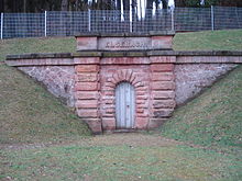
The Elsebach rises northeast of Röhrig at an altitude of about 275 m above sea level. NHN at the Elsebach drinking water tunnel. This spring no longer has an above-ground outlet to the Elsebach.
It flows through the village and flows into the south-eastern outskirts at an altitude of about 235 m above sea level. NHN from the right into the beaver .
On the distance of about 500 meters the stream overcomes a height difference of about 40 meters. It thus has an average bottom slope of around 80 ‰.
Kinzig river system
See also
Web links
Commons : Elsebach (Bieber) - Collection of images, videos and audio files
Individual evidence
- ↑ a b c Google Earth
- ↑ Water map service of the Hessian Ministry for the Environment, Climate Protection, Agriculture and Consumer Protection ( information )

The Elsebach (pipe below) flows into the Bieber

