
Elsterperlenweg
| Elsterperlenweg | |
|---|---|
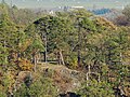
 Signs for the junction over the Zehnmarkweg |
|
| Data | |
| length | 72 km |
| Starting point | Greiz (city information) 50 ° 39 ′ 21 ″ N , 12 ° 11 ′ 59.5 ″ E |
| Target point | Greiz 50 ° 39 '20.9 " N , 12 ° 11' 59.3" E |
| Type | Circular hiking trail |
| Height difference | 117 m |
| The highest point | 412 m |
| Lowest point | 295 m |
The Elsterperlenwanderweg is a circular hiking trail certified by the Association of German Mountain and Hiking Associations with the seal of approval "Quality Trail Hikable Germany". It leads over 72 km from the entrance of Greizer Park via Neumühle / Elster , Berga / Elster , past the Clodramühle through the municipality of Wünschendorf . After crossing the Fuchsbach valley , it reaches Großdraxdorf and continues on the Zehnmarkweg and the Reitsteig with a view of the White Elster valley, past the Albersdorf dam to Berga . Continue to Markersdorf , Untergeißendorf and Mühlberg back to Greiz , where the hiking trail over the Upper Castle to the north entrance of Greiz Park closes. There are 1700 markings and 450 signs on the route.
Viewpoints
The legendary Weiberstein on the plateau near Großdraxdorf

View from Weiberstein into the Elstertal

View from the Reitsteig to the "Oberhammer" before Berga

Lookout point on the Silberberg with a view of Großdraxdorf

The Teufelskanzel near Großdraxdorf

View from the Eulaer Höhenweg


Web links
- Overview map (PDF; 1.3 MB)
- Description and GPX track to the Elsterperlenweg
- From Berga / E. to Zehnmarkweg as a slideshow on YouTube
- From Berga / E. to Neumühle as a slideshow on YouTube
Individual evidence
- ↑ certification. Retrieved September 18, 2012 .
- ↑ Length and description. Retrieved September 18, 2012 .
- ^ Ostthüringer Zeitung local section Greiz on September 9, 2009 "71 kilometers of hiking trail between Greiz and Wünschendorf"