
Enshu Railway Line
| Enshu Railway Line | |||||||||||||||||||||||||||||||||||||||||||||||||||||||||||||||||||||||||||||||||||||||||||||||||||||||||||||||||||||||||||||||||||||||||||||||||||||||||||||||||||||
|---|---|---|---|---|---|---|---|---|---|---|---|---|---|---|---|---|---|---|---|---|---|---|---|---|---|---|---|---|---|---|---|---|---|---|---|---|---|---|---|---|---|---|---|---|---|---|---|---|---|---|---|---|---|---|---|---|---|---|---|---|---|---|---|---|---|---|---|---|---|---|---|---|---|---|---|---|---|---|---|---|---|---|---|---|---|---|---|---|---|---|---|---|---|---|---|---|---|---|---|---|---|---|---|---|---|---|---|---|---|---|---|---|---|---|---|---|---|---|---|---|---|---|---|---|---|---|---|---|---|---|---|---|---|---|---|---|---|---|---|---|---|---|---|---|---|---|---|---|---|---|---|---|---|---|---|---|---|---|---|---|---|---|---|---|---|
 Class 2000 multiple unit on the Enshū line
| |||||||||||||||||||||||||||||||||||||||||||||||||||||||||||||||||||||||||||||||||||||||||||||||||||||||||||||||||||||||||||||||||||||||||||||||||||||||||||||||||||||
 | |||||||||||||||||||||||||||||||||||||||||||||||||||||||||||||||||||||||||||||||||||||||||||||||||||||||||||||||||||||||||||||||||||||||||||||||||||||||||||||||||||||
| Route length: | 17.8 km | ||||||||||||||||||||||||||||||||||||||||||||||||||||||||||||||||||||||||||||||||||||||||||||||||||||||||||||||||||||||||||||||||||||||||||||||||||||||||||||||||||||
| Gauge : | 1067 mm ( cape track ) | ||||||||||||||||||||||||||||||||||||||||||||||||||||||||||||||||||||||||||||||||||||||||||||||||||||||||||||||||||||||||||||||||||||||||||||||||||||||||||||||||||||
| Power system : | 750 V = | ||||||||||||||||||||||||||||||||||||||||||||||||||||||||||||||||||||||||||||||||||||||||||||||||||||||||||||||||||||||||||||||||||||||||||||||||||||||||||||||||||||
| Top speed: | 70 km / h | ||||||||||||||||||||||||||||||||||||||||||||||||||||||||||||||||||||||||||||||||||||||||||||||||||||||||||||||||||||||||||||||||||||||||||||||||||||||||||||||||||||
| Dual track : | No | ||||||||||||||||||||||||||||||||||||||||||||||||||||||||||||||||||||||||||||||||||||||||||||||||||||||||||||||||||||||||||||||||||||||||||||||||||||||||||||||||||||
| Society: | Enshu Tetsudo | ||||||||||||||||||||||||||||||||||||||||||||||||||||||||||||||||||||||||||||||||||||||||||||||||||||||||||||||||||||||||||||||||||||||||||||||||||||||||||||||||||||
|
|||||||||||||||||||||||||||||||||||||||||||||||||||||||||||||||||||||||||||||||||||||||||||||||||||||||||||||||||||||||||||||||||||||||||||||||||||||||||||||||||||||
The Enshū railway line ( Japanese. 遠 州 鉄 道 線 , Enshū Tetsudō-sen ), officially Tetsudō-sen ( 鉄 道 線 , "railway line") is a railway line on the Japanese island of Honshū . It is operated by the Enshū Tetsudō (Entetsu) railway company. In Shizuoka Prefecture , it connects Hamamatsu city center with the northern suburban districts. The term Akaden ( 赤 電 , "Red Train") is also used colloquially .
description
The 17.8 km long route is Cape -lane, single-track and electrified with 750 V DC . 18 train stations and stops are developed, with train crossings - with two exceptions - being possible at all intermediate stations. The southern starting point Shin-Hamamatsu is not directly connected to the Hamamatsu train station , but is about 150 m west of it and forms an integral part of the Entetsu department store . For the first five kilometers, the line runs elevated on a viaduct through the city center, from the Jidōsha-Gakkō-mae station at ground level and with several level crossings . It ends in Nishi-Kajima station , where you can change to the Tenryū Hamanako line operated by Tenryū Hamanako Tetsudō ; However, there is no track connection between the two lines.
Trains
Despite the single track of the route, the traffic on the route is very dense. During the day there is a continuous 12-minute cycle, in the early morning and late evening trains run every 20 minutes. Two railcars tightly coupled together form the basic unit. During rush hour and at major events, two such units are put together to form a four-car multiple unit, but the frequency is not reduced. All trains are painted dark red, hence the nickname Akaden ("Red Train") for the railway line.
history
The tram company Dai Nippon Kidō ( 大 日本 軌道 ), which operates in several Japanese cities, opened the Enshū railway line on December 6, 1909. It initially led from Itaya-chō to Kajima (later names: Enshū-Hamamatsu or Enshū-Futamata) and had a track width of 762 mm. After the liquidation of the Dai Nippon Kidō , the previous Hamamatsu branch was formed on November 12, 1919, which in turn became today's Enshū Tetsudō three and a half decades later . On April 1, 1923, the line was electrified and on Cape gauge (1,067 mm) umgespurt . From a legal point of view, the route was no longer classified as a tram, but as a railway.
At its city-side end, the line was extended to Enshū-Magome on February 1, 1924, but initially only for freight traffic. On September 1, 1927, the extension to Asahi-machi (today Shin-Hamamatsu ) followed. Here had to passenger trains in Enshū-Magome a hairpin busy. With the repeal of the previous northern terminus Enshū-Futamata and the opening of the new Nishi-Kajima station , the route was shortened on March 1, 1938 by about four hundred meters. From 1953 to 1972 the Entetsu offered express trains on the route, and from 1958 to 1966 individual trains ran via Nishi-Kajima to Tenryū-Futamata . On November 21, 1961, the Entetsu increased the contact wire voltage from 600 to 750 V. It stopped freight traffic on April 1, 1976 and relocated the depot from Enshū-Nishigasaki to Nishi-Kajima on December 23, 1977 .
In December 1980, work began on the first leg of the viaduct between Shin-Hamamatsu and Hachiman, and commissioning took place five years later on December 1, 1985. The elimination of the hairpin cut the journey time by four minutes. By relocating the Enshū-Shibamoto station (and thus the creation of another intersection), the journey time on December 1, 1990 was reduced by a further four minutes. From November 24, 2012, the viaduct stretch extended to just before the Jidōsha-Gakkō-mae station, which again made it possible to repeal a number of level crossings.
photos

Class 1000 multiple unit in Hikuma station

Class 2000 multiple unit train
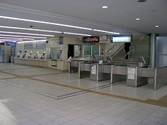
Shin-Hamamatsu Railway Station entrance hall

Nishi-Kajima Railway Station


List of train stations
| Surname | km | Connecting lines | location | place | |
|---|---|---|---|---|---|
| 01 | Shin-Hamamatsu ( 新 浜 松 ) | 0.0 |
at Hamamatsu station : Tōkaidō Shinkansen Tōkaidō main line |
Coord. | Naka-ku , Hamamatsu |
| 02 | Dai-ichi-dōri ( 第一 通 り ) | 0.5 | Coord. | ||
| 03 | Enshū-Byōin ( 遠 州 病院 ) | 0.8 | Coord. | ||
| 04 | Hachiman ( 八 幡 ) | 1.6 | Coord. | ||
| 05 | Sukenobu ( 助 信 ) | 2.4 | Coord. | ||
| 06 | Hikuma ( 曳 馬 ) | 3.4 | Coord. | ||
| 07 | Kamijima ( 上 島 ) | 4.5 | Coord. | ||
| 08 | Jidōsha-Gakkō-mae ( 自動 車 学校 前 ) | 5.3 | Coord. | Higashi-ku , Hamamatsu | |
| 09 | Saginomiya ( さ ぎ の 宮 ) | 6.6 | Coord. | ||
| 10 | Sekishi ( 積 志 ) | 7.8 | Coord. | ||
| 11 | Enshu-Nishigasaki ( 遠 州 西 ヶ 崎 ) | 9.2 | Coord. | ||
| 12 | Enshū-Komatsu ( 遠 州 小松 ) | 10.2 | Coord. | Hamakita-ku , Hamamatsu | |
| 13 | Hamakita ( 浜 北 ) | 11.2 | Coord. | ||
| 14th | Misono-chūō-kōen ( 美 薗 中央 公園 ) | 12.0 | Coord. | ||
| 15th | Enshu-Kobayashi ( 遠 州 小林 ) | 13.3 | Coord. | ||
| 16 | Enshu-Shibamoto ( 遠 州 芝 本 ) | 15.0 | Coord. | ||
| 17th | Enshū-Gansuiji ( 遠 州 岩 水 寺 ) | 16.3 | Coord. | ||
| 18th | Nishi-Kajima ( 西 鹿島 ) | 17.8 | Tenryu-Hamanako Line | Coord. | Tenryū-ku , Hamamatsu |
literature
- Keisuke Imao: 日本 鉄 道 旅行 地 図 帳 (Japan Rail Travel Atlas ) . tape 7 Tōkai. Shinchosha, Tokyo 2008, ISBN 978-4-10-790025-8 .
Web links
- Enshū Tetsudō website (Japanese, English)
Individual evidence
- ↑ Timetable 2018/19. (PDF, 672 kB) Enshū Tetsudō , 2018, accessed on February 12, 2019 (Japanese).
- ↑ 鉄 道 院 年報. 明治 41 、 42 、 43 年度 軌道 之 部. National Parliamentary Library , 1910, accessed February 12, 2019 (Japanese).
- ↑ 地方 鉄 道 運輸 開始. National Parliamentary Library , April 6, 1923, accessed February 12, 2019 (Japanese).