Faial (Madeira)
| Faial | ||||||
|---|---|---|---|---|---|---|
|
||||||
| Basic data | ||||||
| Autonomous Region : | Madeira | |||||
| Concelho : | Santana | |||||
| Coordinates : | 32 ° 47 ′ N , 16 ° 51 ′ W | |||||
| Residents: | 1567 (as of June 30, 2011) | |||||
| Surface: | 24.03 km² (as of January 1, 2010) | |||||
| Population density : | 65 inhabitants per km² | |||||
| Postal code : | 9230-059 | |||||
| politics | ||||||
| Address of the municipal administration: | Junta de Freguesia de Faial Sítio do Lombo Lourenço 9230-059 Faial |
|||||
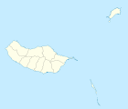
Faial is a municipality on the north coast of Madeira in the district of Santana with an area of 24 km² and 1567 inhabitants (as of June 30, 2011). Faial lies at the foot of the 590 m high, steeply sloping Penha de Águia (German Eagle Rock ).
In Faial there is a school, a church and a karting track .
Pico Ruivo , Madeira's highest mountain, lies on the southern municipal boundary.
administration
Faial is the seat of a municipality of the same name ( Freguesia ). The neighboring municipalities are Santana in the west, Ilha in the northwest, São Roque do Faial in the south, and Porto da Cruz in the east.
Web links
- Faial parish website (as blog)
Individual evidence
- ↑ www.ine.pt - indicator resident population by place of residence and sex; Decennial in the database of the Instituto Nacional de Estatística
- ↑ Overview of code assignments from Freguesias on epp.eurostat.ec.europa.eu


