Farpen reservoir
Coordinates: 53 ° 57 ′ 46 ″ N , 11 ° 33 ′ 8 ″ E
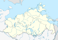
The Farpen reservoir or the Farpen dam is a dam in the northwest of Mecklenburg-Western Pomerania about ten kilometers northeast of Wismar .
The fork-shaped reservoir, which is divided into three directions, has a size of 47 hectares. It is located within the municipal areas of Blowatz and Neuburg in the district of Northwest Mecklenburg . The Blowatzer district of Alt Farpen is located near the dam , at the northwest end of the lake. Neuburg and its district of Neu Farpen lie south of the water.
The dam was built between 1976 and 1978 for agricultural irrigation. According to several sources, the Farpener Bach is dammed. In the digital maps of the geodata portal MV, the tributaries in the south and northeast have no names and the outflow in the northwest is referred to as the Plastbach, which merges into the Lazy Bach and flows into the Breitling of the Wismar Bay. The mean water level of the reservoir is 14.2 m above sea level. NHN indicated. The mean depth is about 1.3 meters. The reservoir is largely surrounded by forests.
The data on the volume of water vary between 0.8 and 1.2 million cubic meters.
In Mecklenburg-Western Pomerania there are only a few other open water reservoirs besides the Farpen reservoir , including the Brohm dam , the Andershofer pond used as a reservoir and the small Kemnitzerhagen reservoir .
See also
- List of lakes in Mecklenburg-Western Pomerania
- List of bodies of water in Mecklenburg-Western Pomerania
- List of dams in Germany
Web links
Individual evidence
- ↑ a b Geodata Viewer of the Office for Geoinformation, Surveying and Cadastral Affairs Mecklenburg-Western Pomerania ( notes )
- ↑ a b u. a. Water Framework Directive MV - Flow regulations


