Fig valley sky
| Fig valley sky | ||
|---|---|---|
|
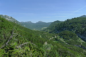
Henarwald from the Hochklapfsattel. Feigentalhimmel (left) and Woising (center) in the background |
||
| height | 1984 m above sea level A. | |
| location | Styria and Upper Austria , Austria | |
| Mountains | Dead Mountains | |
| Dominance | 1.5 km → Großer Woising | |
| Notch height | 279 m ↓ Feigentalgrube | |
| Coordinates | 47 ° 43 '18 " N , 13 ° 53' 11" E | |
|
|
||
| rock | Dachstein Limestone | |
| Age of the rock | Triad | |
| Development | alpine path | |
The Feigentalhimmel is a 1984 m above sea level. A. high summit in the Dead Mountains on the border between Styria and Upper Austria .
location
Towards the northeast, the mountain made up of Dachstein limestone from the Triassic breaks off steeply towards the Almsee . In the southwest it towers over the Henarwald and the mountain plateau of the Dead Mountains overgrown with pines towards the Albert-Appel-Haus . The Wildensee is located about 2.6 km to the southwest .
Approaches
The Feigentalhimmel can be reached in 2 hours from the Wildenseealm via a path marked with cairns .
In winter, the mountain can be climbed with snowshoes or skis.
At the summit of the Feigentalhimmel there is a wooden summit cross and a summit book is available.
Literature & Maps
- Alpine Club Map Bl. 15/1 (Totes Gebirge - West), 1: 25,000; Austrian Alpine Club 2014; ISBN 978-3-928777-29-2 .
- ÖK 50, sheet 97 (Bad Mitterndorf)
Web links
- Witzi's mountain world: Feigentalhimmel and Weißhorn ; accessed on September 24, 2016
Individual evidence
- ↑ manfredsberge.blogspot.co.at: Feigentalhimmel ; accessed on September 24, 2016

