Ferpècle glacier
| Ferpècle glacier | ||
|---|---|---|
|
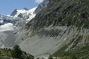
Lateral moraines of the receding Ferpècle Glacier |
||
| location | Canton of Valais , Switzerland | |
| Mountains | Valais Alps | |
| Type | Valley glacier | |
| length | 6.4 km (2011) | |
| surface | 9.79 km² (1975) | |
| Exposure | Nutrient area northwest, consumption area north | |
| Altitude range | 3680 m above sea level M. - 2095 m above sea level M. (1983) | |
| Ice volume | 0.97 ± 0.24 km³ (1993) | |
| Coordinates | 610 213 / 97831 | |
|
|
||
| drainage | Borgne de Ferpècle , Borgne , Rhone | |
The Ferpècle Glacier (French Glacier de Ferpècle ) is one of the glaciers in the southern end of the Val d'Hérens , southeast of Evolène in the Valais Alps . It has a length of just over 6 km and in 1975 covered an area of 9.8 km².
location
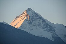
The Ferpècle glacier takes its starting point on the ridge between the Tête Blanche ( 3710 m above sea level ), over which the border between Italy and Switzerland runs, and the Dent Blanche at around 3600 m . The relatively flat glacial ice field in the upper part is also called the Plateau d'Hérens . The Ferpècle glacier is connected to the Zmutt glacier system via the Col d'Hérens ( 3459 m above sea level ) ; to the west, it is connected to the Mont Miné glacier , which runs parallel to it, over the firn-covered ridge north of the Tête Blanche . The glacier flows north, flanked by the four-thousand-meter Dent Blanche in the east and Mont Miné ( 3,029 m above sea level ) in the west. The glacier tongue is currently at an altitude of around 2100 m . The Borgne de Ferpècle , which brings the meltwater through the Val d'Hérens to the Rhone , rises here .
During the high stage of the Little Ice Age in the middle of the 19th century, the tongues of the Ferpècle and Mont Miné glaciers merged north of Mont Miné and flowed together for about a kilometer down the valley. Since then, however, both glaciers have receded sharply. In the connecting area, a marginal lake built up temporarily, which erupted in the summer of 1952 and caused a flood of damage in the Val d'Hérens.
Above the Ferpècle glacier on the slope of the Dent Blanche, the mule track , which was often used in Roman times, led from Val d'Hérens to Valpelline in Italy. Remnants of this high alpine route (in the firn-covered Col de Valpelline 3562 m above sea level ), which was expanded by the Romans into a military road, are still partially preserved.
Web links
- Ferpècle Glacier on the ETHorama platform
- Research Institute for Hydraulic Engineering, Hydrology and Glaciology (VAW) of the ETH Zurich : Glacier de Ferpècle, Glacier de Mont Miné. In: Glacier Natural Hazards. ( ethz.ch ( page no longer available ), also as a PDF ( page no longer available )).
- Map section at map.geo.admin.ch
Individual evidence
- ^ Research institute for hydraulic engineering, hydrology and glaciology (VAW) of the ETH Zurich (ed.): Ferpècle-Gletscher. In: Swiss Glacier Measurement Network. ( ethz.ch , also as PDF , accessed on January 3, 2014).
- ↑ a b WGMS: Fluctuations of Glaciers Database. World Glacier Monitoring Service, Zurich 2013 ( DOI: 10.5904 / wgms-fog-2013-11 ), accessed on December 11, 2013
- ↑ Daniel Farinotti, Matthias Huss, Andreas Bauder, Martin Funk: An estimate of the glacier ice volume in the Swiss Alps. In: Global and Planetary Change. 68: 225-231, 2009 ( online ; PDF; 756 kB).


