Dent Blanche
| Dent Blanche | ||
|---|---|---|
|
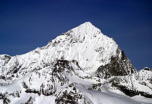
Dent Blanche from the east, left the south ridge (normal route), right the east ridge ("Viereselsgrat") |
||
| height | 4357 m above sea level M. | |
| location | Canton of Valais , Switzerland | |
| Mountains | Valais Alps | |
| Dominance | 7.4 km → Matterhorn | |
| Notch height | 895 m ↓ Col d'Hérens | |
| Coordinates | 613 461 / 97992 | |
|
|
||
| First ascent | July 18, 1862 by Thomas Stuart Kennedy , William and C. Wigram with the guides Jean-Baptiste Croz and Johann Kronig | |
|
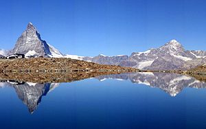
Matterhorn and Dent Blanche |
||
|
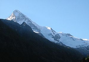
Dent Blanche from the northwest, from the Val d'Hérens |
||
The Dent Blanche is a largely ice-free mountain peak in the Valais Alps , in the south of the canton of Valais , around 10 km west of Zermatt . With a height of almost 4357 m above sea level. M. is the Dent Blanche in sixteenth place of the highest peaks in the Alps. The language border between French and German runs across the Dent Blanche in Upper Valais.
Surname
It is very likely that the Dent Blanche ("White Tooth") was confused with the Dent d'Hérens , which a monk made a long time ago while copying a map. This thesis is underpinned by the fact that the Dent d'Hérens of the Val d'Hérens is only visible in very few places, while the Dent Blanche has significantly less white firn surfaces than the Dent d'Hérens.
A German name is no longer in use for Dent Blanche today. However, the name "Steinbockhorn" is historically guaranteed.
location
From the top of the mighty Dent Blanche pyramid, four ridges run exactly in the four cardinal directions, although the ridge to the south is not quite as steep and gradually ends in the Wandfluh ridge. The Dent Blanche, together with its neighboring peaks to the east, Ober Gabelhorn and Zinalrothorn, form the southern end of the Val de Zinal, which is part of the Val d'Anniviers valley system . The Val d'Hérens begins west of the mountain , in the valley at the southeast foot of the Dent Blanche stretches the Zmutt glacier , whose meltwater flows off to Zermatt and then through the Mattertal .
The northeast flank of Dent Blanche is glaciated almost to the summit. On all other flanks, the glacier ice does not reach higher than at 3700 m . On the western slope of the Dent Blanche there are two short glaciers, 1 to a maximum of 2 km long: the Glacier de la Dent Blanche and the Glacier des Manzettes . The 4 km long Schönbiel Glacier , a northern side glacier of the Zmutt Glacier, has its origin at the foot of the southeast flank . The Glacier du Grand Cornier pours out to the northeast in the direction of Val de Zinal and joins other glaciers to form the Zinal Glacier .
geology
Geologically, the Dent Blanche and the neighboring peaks (including the Matterhorn ) form a cliff of the Eastern Alpine blankets . This isolated remnant of the tectonic blanket, which otherwise occurs almost exclusively in the Eastern Alps, was originally part of the African plate. The so-called Dent-Blanche Nappe consists of metamorphic rock ( gneiss and gabbro ) and contrasts strongly with the greenish rock of the ophiolites of the Pennine Nappe , which lie under the Dent-Blanche Nappe and are exposed in the valleys.
bases
South of the Dent Blanche at an altitude of 3507 m above sea level. M. is the Cabane de la Dent Blanche , a hut belonging to the Swiss Alpine Club (SAC). It can be reached from Val d'Hérens via the Glacier des Manzettes. From here the normal route leads over the south ridge to the summit.
First ascent
The mountain was first climbed on July 18, 1862 by Thomas Stuart Kennedy , William and C. Wigram with the guides Jean-Baptiste Croz and Johann Kronig over the south ridge ("Wandfluhgrat").
Routes
Südgrat (normal route) ("Wandfluhgrat")
- Difficulty: ZS , with III. UIAA grade rock climbing
- Time required: 4 hours
- Starting point: Cabane de la Dent Blanche ( 3507 m above sea level )
- Valley location: Ferpècle ( 1766 m above sea level )
Ostnordostgrat ("Viereselsgrat")
- Difficulty: S , with III +. UIAA grade rock climbing
- Time required: 9 hours
- Starting point: Schönbielhütte ( 2694 m above sea level )
- Valley location: Zermatt ( 1609 m above sea level )
West ridge ("Ferpèclegrat")
- Difficulty: S + , with IV +. UIAA grade rock climbing
- Time required: 7 hours
- Starting point: Cabane de la Dent Blanche ( 3507 m above sea level )
- Valley location: Ferpècle ( 1766 m above sea level )
literature
- Helmut Dumler, Willi P. Burkhardt: Four-thousanders in the Alps. 12th, updated edition. Bergverlag Rother, Munich 2001, ISBN 3-7633-7427-2 .
Web links
- Dent Blanche at 4000m - the four-thousanders of the Alps
- Dent Blanche on the ETHorama platform
- Ascent of the Dent Blanche
- Dent Blanche Nappe geology


