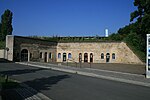
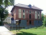
Torgau Fortress
The Fortress Torgau developed in the 17th and 18th centuries from an extension of the medieval city walls. In 1811 it was expanded as a Saxon fortress under King Friedrich August I at the request of Napoleon Bonaparte . After the end of the wars of liberation , Torgau had to be handed over to Prussia by the Kingdom of Saxony in 1815 . The fortress was now expanded as a Prussian fortress until it was abandoned in 1889 and largely demolished in the following decades.
development
Prehistory (until 1805)
The city of Torgau had had a city wall since the Middle Ages , which ran around the city in a ring shape and ran roughly along the streets of Gartenstrasse, Rudolf-Breitscheidstrasse and Promenade. The facilities were later expanded. The city wall with a moat can be seen in a map from 1650 . In the north of the city there is an upstream rampart with three full and two half bastions and a wet ditch in front of it . The western bank of the Elbe is also protected by two half-bastions. On the opposite bank of the Elbe there is a citadel-shaped bridge jump to secure the Elbe bridge. This is followed by a short wall with a bastion and moat to protect the south side.
Saxon Elbe and state fortress (1806–1813)
The Kingdom of Saxony was established in 1806 with the signing of the Poznan Peace Treaty between France and Saxony and had to join the Rhine Confederation . Napoleon Bonaparte asked Saxony to build a fortress on the Elbe in order to obtain a military base for his Russian campaign . The cities of Dresden, Wittenberg and Torgau were examined as possible locations. In 1810 the decision was made to expand Torgau.
In 1811 the construction of the fortifications began. An earth wall with six full and two half bastions was built around the city. The water in the moat was derived from the Schwarzen Graben and the large pond southwest of Torgau . The areas to the south in front of the wall could also be flooded during an attack ( inundation ) to make access to the walls more difficult. Fort Zinna was built in the northwest to secure the hill there, while Fort Mahla to the east. In addition, the eastern end of the Elbe bridge was secured by a new bridgehead and two side lunettes .
After Napoleon's defeat in the Russian campaign of 1812 , the wars of liberation began . The French had to withdraw further and further west. In May 1813, the Torgau fortress was placed under French command. During the subsequent siege of Torgau by Prussian troops, it was forced to surrender at the end of 1813.
Prussian fortress (1815-1889)
By the resolutions of the Congress of Vienna in 1815, Prussia received the northern part of Saxony, including Torgau. The fortress was expanded in the following decades under General of the Infantry Gustav von Rauch , the General Inspector of the Prussian fortresses. The existing facilities were reinforced by bomb-proof casemates and reduits in order to be able to safely accommodate the crew and equipment in the event of enemy fire. Counter mines were built in Fort Zinna to prevent undermining . In the urban area and in the fortifications, other buildings used by the military such as barracks, provisions and material stores were built. The hard rock castle was converted into a defensive barracks. The water flow for inundation was further expanded, among other things to be able to flood the northern areas in front of the wall. The water level in the trenches could be regulated by erecting a batardeau in front of the outermost half-bastion. The Elbe bridge of the former Halle-Sorau-Guben Railway , which was put into operation in 1872 , had a fortification on both banks in the form of a block house with opposite wall and two turrets. The track axis could be blocked by lattice gates.
The further development of the artillery made the fortifications of Torgau militarily ineffective with the looming explosive shell crisis . Fort Mahla was razed as early as 1878. In 1889 the fortress status was given up and the rayon laws repealed.
Further development (1889–1989)
After the transfer to the city, the fortress works began to be converted or demolished. The earth walls were almost completely removed, the glacis in front of it on the northern and western fronts was converted into a city park. The remaining flank casemates were used as storage space by the city administration and commercial enterprises. The defensive barracks on the bridgehead was used as the Torgau Wehrmacht prison from 1939 to 1945 . Fort Zinna was almost continuously a prison that was used by various administrations, including as the Wehrmacht prison in Torgau and, after the end of the Second World War, as the Soviet special camp No. 8 and No. 10 in Torgau. After 1950, Fort Zinna was again a civilian prison for the People's Police .
Still existing fortifications
| object | location | image |
|---|---|---|
| . | . | . |
| Medieval city wall | location |

|
| Hartenfels Castle | location |

|
| Oberhaafentor | location |

|
| Southern batardeau | location |

|
| Casemates on the flanks of Bastion II, today's cultural bastion | location |

|
| Curtain wall between Bastion II and II including access to a postern | location |

|
| Left flank casemates of Bastion III | location |

|
| Glacis , today's city park | location | . |
| Right flank casemates of Bastion VII | location |

|
| Northern batardeau | location |

|
| Large pond with an outlet | location |

|
| Lock lunette, with house built afterwards | location |

|
| Bridgehead including remains of the ramparts, moat, western wall and the original location of the trunk road around the bridgehead. | location |

|
| Defensive barracks in the bridgehead | location |

|
| Elblunen Werdau | location |

|
| Elblunen Zwetau | location | . |
| Loßwig lunette, torn off and only available as a street name | location | . |
| Tin towers of the railway bridge | location |

|
| Fort Zinna, today's Torgau correctional facility | location |

|
See also
literature
- Horst Müller and Heinrich Witte: The Saxon-Prussian fortress Torgau: (1810-1893). In: Small writings of the Torgauer Geschichtsverein, Volume 5. Torgau, 1995. Entry in the catalog of the German National Library
- Andreas Rietz: Torgau. In: Historical fortresses in the Middle East of the Federal Republic of Germany. Fraunhofer-IRB-Verlag. Stuttgart 2000. pp. 205–232 Entry in the catalog of the German National Library
- The Saxon-Napoleonic fortress Torgau. In: Kleine Schriften des Torgauer Geschichtsverein, issue 23. Torgau, 2011. Entry in the catalog of the German National Library
- Uwe Niedersen: Guided tours through the Torgau Fortress. Publisher: Friends of Europe Encounters e. V.
City maps
- Martin Zeiller: Topographia Superioris Saxoniae Thüringiae / Misniae Lusatiae etc. Plate after p. 182: Ground plan of the city of Torgau. Published in Frankfurt am Main, 1650. Digital copy from Düsseldorf University Library
- Starcke, Johann Georg, Ed .: Theatrum urbium . Sheet 230: Floor plan of the city of Torgau. Published 1695. Digital copy from the Deutsche Fotothek.
- Military map of Torgau, copper engraving, digital copy from the Deutsche Fotothek after 1760 .
- Miles sheets from Saxony, Dresden copy, 1:12 000, hand drawing, from 1792, sheets 1-300. Sheet 49: Torgau, 1:12 000, digital copy from the Deutsche Fotothek.
- Measuring table sheet 2538/2539: Torgau, 1912 digital copy from the Deutsche Fotothek.
supporting documents
- ↑ Chapter 9a. Title 2: Proceeds from the sale of the land of the now dispensable Mahla lunette of the Torgau fortress. 33,850 marks for the budget year 1877/78. Law regarding the establishment of the budget of the German Reich for the budget year 1877/78 . Published: Deutsches Reichsgesetzblatt Volume 1877, No. 19, pp. 425–489
Web links
- History of Torgau Fortress on the website of the Friends of Europe Encounters e. V.
- Torgau documentation and information center of the Saxon Memorials Foundation.
- Starcke, Johann Georg, Ed .: Theatrum urbium . Sheet 101: View of the city of Torgau. Published 1695. Digital copy from the Deutsche Fotothek.
Coordinates: 51 ° 33 ′ 30 ″ N , 13 ° 0 ′ 15 ″ E
