
Fil Liung
| Fil Liung | ||
|---|---|---|
| height | 3062 m above sea level M. | |
| location | Canton border Ticino / Graubünden , Switzerland | |
| Mountains | Adula Alps | |
| Dominance | 1.5 km → Piz Medel | |
| Notch height | 65 m ↓ ridge between Fil Liung and Piz Medel | |
| Coordinates | 713 159 / 165 541 | |
| Topo map | Swisstopo 1: 25000 sheet 1233 Greina | |
|
||

The Fil Liung is a ridge near the Piz Medel with an altitude of 3062 m above sea level. M. he rises Like the other summit of Medelsermassivs only slightly over the territory of Glatscher since Medel . The name is Rhaeto-Romanic in the idiom Sursilvan and means long ridge . The first to climb Piz Medel chose a route over Fil Liung. Today the mountain is relatively insignificant as a tour destination. The ascents from the Medelserhütte to the Fil Liung are described in the SAC club guide with the level of difficulty WS .
gallery
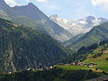
Piz Medel (r.) And Fil Liung (l.) From Acletta
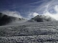
Fil Liung from Glatscher da Medel


Web links
Individual evidence
- ↑ SAC Club Guide Bündner Alpen 2, 5th edition 1996, pp. 103, 104, 107