Finnmarksvidda
| Finnmarksvidda | ||
|---|---|---|
|
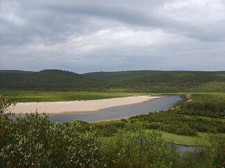
The lowest elevations can be found in the east of Finnmarksvidda, near Karasjok and Tana . The river valleys in the area are only 100-250 m high . |
||
| location | Troms og Finnmark ( Norway ) | |
|
|
||
| Coordinates | 69 ° 19 ′ N , 23 ° 49 ′ E | |
Finnmarksvidda ( North Sami Finnmárkkoduottar ) is the largest high plateau in Norway , with an area of over 22,000 km². The plateau lies between 300 m and 500 m above sea level and covers about 36% of Finnmark in the province of Troms og Finnmark
geography

From Alta in the west to the Varanger peninsula in the east, the area extends approximately 300 km, with the extent from north to south being at least as large. In the south, the highlands continue into Finland . The Øvre Anárjohka National Park is located in the southeastern part of the plateau . The 1st 409 km² park was opened in 1976.
fauna and Flora
The plateau contains large birch forests , small- stemmed , relatively dry pine forests ( English pine barrens ), moors and glacial lakes formed during the Ice Age . Finnmarksvidda is completely north of the Arctic Circle and is best known as the land of the nomadic Sami and their reindeer herds . Their shelters on the tundra are still used in winter.
climate
Finnmarksvidda is located in the interior of the country and has a continental climate with the lowest winter temperatures in Norway. The lowest temperature ever recorded in Norway was -51.4 ° C in Karasjok on January 1, 1886. The 24-hour average temperatures in January and July at the same location are -17.1 ° C and 13.1 ° C, while the annual average is -2.4 ° C. The amount of precipitation is only 366 mm per year In Karasjok temperatures up to 32.4 ° C were already measured in July, which results in a possible annual temperature fluctuation of 84 K, which is rare in Europe. The annual mean temperature on the plateau is -3 ° C, measured at Šihččajávri in Kautokeino , which is the lowest average temperature on the Norwegian mainland, apart from mountain peaks, even lower than on Jan Mayen and Bear Island ( Bjørnøya in Norwegian ).
Individual evidence
- ^ About Finnmark. Turistforeningen, accessed on January 27, 2013 (English).
- ↑ Leif Ryvarden . Stabbursdalen, Øvre Pasvik and Øvre Anárjohka . Gyldendal, 2007 ( Norges nasjonalparker ; 3) ISBN 978-82-05-37638-0
- ↑ met.no. Retrieved January 28, 2013 .


