Finstermünzpass
| Finstermünzpass | |||
|---|---|---|---|
| Compass direction | North | south | |
| Pass height | 1186 m above sea level A. | ||
| district | Landeck , Tyrol | ||
| Valley locations | Pfunds | Nauders | |
| expansion | 180 Reschenstrasse | ||
| Mountains | Ötztal Alps | ||
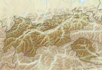
| Map (Tyrol) | |||
|
|
|||
| Coordinates | 46 ° 54 '48 " N , 10 ° 29' 36" E | ||
The Finstermünzpass is a bottleneck in the Reschenstraße at the Nauders lock fort in the Landeck district, Tyrol. This narrow point is not a pass in the actual sense of the word, since the designated point is neither a watershed nor a road or path height from which the terrain on the other side leads downwards. The Finstermünzpass marks the transition from the steep route of the Finstermünzstraße cut out of the rock into the high valley of the Stillebach .
The road runs here on the right side of the Stillebach and thus in the Ötztal Alps , before it changes to the left for a short time and runs there in the Sesvenna group .
Originally the place name "Finstermünzpass" referred to the former customs and toll collection point at the Siegmundsegg Fortress in Altfinstermünz , through which traffic to Italy was already carried out in Roman times. This traffic connection lost its importance with the opening of Finstermünzstraße in 1854 and was finally abandoned entirely. The new traffic route, which begins at the Kajetansbrücke in Pfunds and leads via Hochfinstermünz to Nauders, has a narrow point shortly before Nauders, which was additionally secured with a fortress. Those who “passed” this road block were no longer faced with any obstacles on the remaining two and a half kilometers to the village of Nauders , so that the name Finstermünzpass has become established for this narrow point, where the cart path leading up from Altfinstermünz used to come . Today's Museum fortress Nauders is located here .
Individual evidence
- ^ Julius Meurer , President of the Austrian Alpine Club. Forays through the Ortler area; Illustrirte Zeitung 1890, Vol. 95, Page 192 Landeck via Finstermünz and Reschen-Scheideck to Stilfser Joch Straße
- ↑ Cultural assets in Tyrol, along the Via Claudia Augusta, on foot, by bike or by car along the Via Claudia Augusta through the districts of Reutte, Imst and Landeck. Association Miar, Herta Arnold, Elisabeth Walde, Karl Wiesauer, Gerald Grabherr. Pp. 67-68.
