Fleming Key
| Fleming Key | ||
|---|---|---|
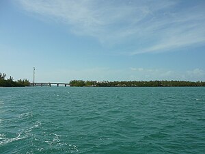
| The southern part of Fleming Key and the Fleming Key Bridge as seen from the east. | ||
| Waters | Gulf of Mexico | |
| Archipelago | Florida Keys | |
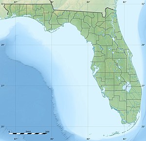
| Geographical location | 24 ° 34 '12 " N , 81 ° 47' 38" W | |
|
|
||
| length | 3 km | |
| width | 400 m | |
| surface | 1.152 488 km² | |
| Residents | uninhabited | |
Fleming Key is an island of the Florida Keys , which belongs to the urban area of Key West and thus to Monroe County (Florida) . It is about 3.0 kilometers long, 0.4 kilometers wide and has an area of exactly 1,152,488 m² (57,039 m² of which is inland water). No permanent population was recorded for the 2000 census. It is connected to the island of Key West by the Fleming Key Bridge (Mustin Road), which overcomes a distance of 55 meters over the Fleming Key Cut.
The island and the bridge road are part of the Key West Naval Air Station Trumbo Point and can not be entered by civilians without permission from the US Navy . There is also a sewage treatment plant, a dolphin research center and a marine corrosion test facility on the island .
gallery
Individual evidence
- ↑ Blocks 1022 (with inland waterways), 1023, 1024, 1025 in Census Tract 9721, Monroe County, Florida
- ↑ Key West City - directions to Garrison Bight Marina ( Memento of the original from November 5, 2006 in the Internet Archive ) Info: The archive link was automatically inserted and not yet checked. Please check the original and archive link according to the instructions and then remove this notice.
- ↑ Key West Wastewater


