
Fort Dearborn
| Fort Dearborn | |||
|---|---|---|---|
| National Register of Historic Places | |||
| Historic District Contributing Property | |||
![Drawing from 1856 of what Fort Dearborn looked like in 1831 [1]](https://de.wikipedia.org/wiki/Datei:Fort_Dearborn_1831_Kinzie.jpg) Drawing from 1856 of what Fort Dearborn looked like in 1831 |
|||
|
|||
| location | Chicago , Illinois | ||
| Coordinates | 41 ° 53 '18 " N , 87 ° 37' 29" W | ||
| architect | US Army | ||
| Architectural style | Blockhouse fort with double palisade | ||
| NRHP number | 78001124 | ||
| The NRHP added | |||

The Fort Dearborn was originally built in 1803 by troops under Captain John Whistler fortress in Chicago . The fort was on the Chicago River at the point where Wacker Drive and Michigan Avenue intersect today; it was named in honor of Henry Dearborn . During the British-American War of 1812, the fort was burned down by the Potawatomi . After the war, a second Dearborn Fort was built on the same site in 1816. This was destroyed by various fires in the 19th century, including the Great Fire of Chicago . The leftmost star on the Chicago flag represents Fort Dearborn; it was added to the flag in 1939. The site of the fort has been a Chicago Landmark since 1971 and is located in the Michigan – Wacker Historic District .
background

The history of human settlement in what is now Chicago before the arrival of the whites is largely unknown. In 1673, an expedition led by Louis Jolliet and Jacques Marquette was the first to demonstrate the passage through the Chicago Portage and along the Chicago River. Marquette returned in 1674 and camped at the mouth of the river for a few days, then moved to the portage and spent the winter of 1674–75 there. Joliet and Marquette did not report whether Indians lived on the Chicago River at the time, but archaeologists in the Chicago area have unearthed numerous Indian settlements from this period. Two of de La Salle's men built a palisade at the portage in the winter of 1682/1683 .

In 1682 de La Salle took possession of a large area for France, including what is now the Chicago region. A Jesuit mission, the Mission of the Guardian Angel , was founded in this area in 1696, but abandoned as early as 1700. In 1763, after the French and Indian Wars , the French ceded this area to the Kingdom of Great Britain and incorporated it into the Province of Quebec . Great Britain ceded the area to the United States after the American War of Independence , while the Northwest Territory remained de facto under British control until 1796 .
The Fox Wars ( 1712-1716 and 1728-1733 ) largely prevented access to the area for European settlers during the first half of the 18th century. The first non-Indian settler to re-settle in the area was believed to be a merchant named Guillory, who was believed to have had a trading post at Wolf Point around 1778 . Jean Baptiste Point du Sable built a farm with trading post not far from the mouth of the Chicago River in the 1780s, which is why he is widely regarded as the founder of Chicago. Antoine Ouilmette is the closest known resident in the Chicago area; he claims to have settled at the mouth of the Chicago River in July 1790.
After the Northwest Indian War (1785–1795), the Treaty of Greenville was signed on August 3, 1795 in Fort Greenville (today's Greenville , Ohio ) . With this, a coalition of Indians and Frontiersmen , the so-called Western Confederacy , transferred large parts of the present-day states of Ohio, Michigan , Indiana , Wisconsin and Illinois to the United States . This included "six square miles" centered at the mouth of the Chicago River.
First Fort Dearborn
On March 9, 1803, Henry Dearborn , the Secretary of War , wrote to Colonel Jean Hamtramck , the Detroit commander , instructing him to dispatch an officer and six low-ranking soldiers to scout the Detroit-Chicago route and conduct a preliminary investigation able to do in Chicago. Captain John Whistler was chosen to command the new post, and he set out with six other men. The reconnaissance was completed on July 14, 1803, and a company of soldiers set out to travel overland from Detroit to Chicago. Whistler and his family made the trip to Chicago on the schooner Tracy . The troops reached their destination on August 17th. The Tracy anchored about a mile from shore because a sandbar prevented her from entering the Chicago River. Julia Whistler, the wife of Captain Whistler's son, Lieutenant William Whistler, later said that 2,000 Indians had gathered to see the Tracy . The troops finished construction of the fort in the summer of 1804; the fort was enclosed by a double row of palisades and had two log houses . The fort was named Fort Dearborn , after Henry Dearborn, who ordered its construction.

The fur trader John Kinzie arrived in Chicago in 1804 and quickly became the leader of the civil society in the small settlement that developed around the fort. In 1810 Kinzie and Whistler got into an argument because Kinzie was supplying alcohol to the Indians. In April Whistler and other senior officers were recalled; Whistler was replaced as the fort in command by Captain Nathan Heald .
During the British-American War , General William Hull ordered the evacuation of Fort Dearborn in August 1812. This was done by Capt. Heald monitors. On August 15, the trek with the evacuees was ambushed by around 500 Potawatomi . The Potawatomi captured Heald and his wife Rebekah and handed them over to the British for ransom. Of the 148 soldiers, women and children who left the fort, 86 were killed in the ambush. The Potawatomi burned the fort down the next day.
The second fort


After the war, a new fort was built on the site in 1816. This too had a double palisade and had barracks for officers and men, a garden and other buildings. American forces held the fort until 1823, when a peace treaty with the Indians suggested that the garrison was no longer necessary. This condition prevailed until 1828, when it was reoccupied by the US Army as a result of the war with the Winnebago . In her 1856 memoir Wau Bun , Juliette Kinzie described the fort as it looked when she arrived in Chicago in 1831:
“The fort was inclosed [sic!] By high pickets, with bastions at the alternate angles. Large gates opened to the north and south, and there were small portions here and there for the accommodation of the inmates. ... Beyond the parade-ground which extended south of the pickets, were the company gardens, well filled with currant-bushes and young fruit-trees. The fort stood at what might naturally be supposed to be the mouth of the river, yet it was not so, for in these days the latter took a turn, sweeping round the promontory on which the fort was built, towards the south, and joined the lake about half a mile below. "
“The fort was surrounded by tall stakes, with bastions at the opposite corners. Large gates opened to the north and south, and there were small compartments here and there for the accommodation of inmates. ... Behind the parade ground, which stretched south of the pegs, were the company gardens, well filled with currant bushes and young fruit trees. The fort stood there, which one would naturally regard as the mouth of the river, but it was not so, because in those days the latter made a bend, snaked around the promontory on which the fort is built to the south and about half a turn Mile down into the lake. "
The fort was closed a short time before the Black Hawk War of 1832, and was used by the Superintendent of Harbor Works until 1837. In 1837, the fort and its land reserve, including the land that would later become Grant Park , was transferred to the city by the United States federal government . In 1855, part of the fort was demolished so that the south bank of the Chicago River could be dredged to straighten the bend in the river and to widen the river by about 45 m at this point; and in 1857 a fire destroyed almost all of the structures left in the fort. The log cabin and a few remaining outbuildings were eventually destroyed in the Great Chicago Fire in 1871 .
Remnants and culture of remembrance
.jpg)
The southern edge of Fort Dearborn was at today's intersection of Wacker Drive and Michigan Avenue within the Chicago Loop , along the Magnificent Mile . Parts of the fort's outer perimeter are now marked by plaques and a line that is embedded in the sidewalk and roadway not far from Michigan Avenue Bridge and Wacker Drive. A few boards from the old fort are in the Chicago History Museum in Lincoln Park .
On March 5, 1899, the Chicago Tribune reported a model of the original fort that the Chicago Historical Society had created. In 1933, a detailed model of Fort Dearborn was erected at the Century of Progress Exhibition . The United States Postal Administration issued a 1 ct face stamp and a reminder sheet with 25 of these stamps showing the fort for this reason . These stamps and souvenir sheets were reprinted when Postmaster General James A. Farley gave imperforate copies of these and other stamps to his friends. As a result of the outcry, millions of copies of Farley's Follies have been printed and sold.
In 1939, the Chicago City Council decided to add a fourth star to the flag of Chicago , representing Fort Dearborn. This star is the first star from the left.
On September 15, 1971, the fort's site was declared a Chicago Landmark .
photos

Plaquette which the Fort Dearborn as a Chicago Landmark identifies
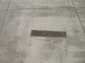
Plaquette embedded in the sidewalk to mark the location of the fort


supporting documents
- ↑ Kinzie, 1856. p. 182.
- ↑ Quaife 1913, pp. 22-24.
- ↑ Quaife 1933, p. 18.
- ^ John F Swenson: Chicago: Meaning of the Name and Location of Pre-1800 European Settlements ( English ) In: Early Chicago . Early Chicago Inc. Retrieved March 8, 2019.
- ^ Edward Mason: Chapters from Illinois History ( English ). Herbert S. Stone and Company, Chicago 1901, p. 144, (Retrieved March 8, 2018).
- ^ Richard Worth: Louisiana, 1682-1803 ( English ). National Geographic Books, 2006, ISBN 978-0-7922-6544-3 , p. 19.
- ^ Winstanley Briggs: Mission of the Guardian Angel ( English ) In: The Electronic Encyclopedia of Chicago . Chicago Historical Society. 2005. Retrieved March 8, 2019.
- ↑ Quaife 1933, pp. 63-64.
- ↑ Thomas A. Meehan: Jean Baptiste Point du Sable, the First Chicagoan . In: Journal of the Illinois State Historical Society . 56, No. 3, 1963, pp. 439-453.
- ↑ Pacyga 2009, p. 12.
- ↑ Timothy E. Baumann: The Du Sable Grave Project in St. Charles, Missouri . In: The Missouri Archaeologist . 66, December 2005, pp. 59-76.
- ↑ Shirley Graham: Jean Baptiste Pointe De Sable Founder of Chicago ( English ). Julian Messner, 1953 (accessed March 8, 2019).
- ^ Letter from Antoine Ouilmette to John H. Kinzie dated June 1, 1839; reprinted in Rufus Blanchard: Discovery and Conquest of the North West, with the History of Chicago (volume 1) ( English ). R. Blanchard and Company, 1898, p. 574 (Retrieved September 7, 2019).
- ^ Charles J. Kappler: Treaty With the Wyandot, etc., 1795 ( English ) In: US Government treaties with Native Americans . Oklahoma State University Library. 1904. Archived from the original on November 8, 2010. Retrieved March 7, 2019.
- ^ Winstanley Briggs: Fort Dearborn ( English ) In: The Electronic Encyclopedia of Chicago . Chicago Historical Society. 2005. Retrieved March 8, 2019.
- ↑ Quaife, 1933. pp. 65-66.
- ↑ a b c Pacyga, 2009. p. 13.
- ↑ Currey, 1912. p. 24.
- ↑ Quaife, 1933. P. 72.
- ↑ Quaife, 1933. p. 75.
- ^ Benson Lossing: The Pictorial Field-Book of the War of 1812 ( English ). Harper & Brothers, Publishers, 1868, p. 303.
- ↑ Pacyga, 2009. p. 14
- ↑ Kinzie, 1856. pp. 183-184.
- ↑ United States v. Illinois cents. R. CO., 154 US 225 (1894) ( English ) Retrieved March 9, 2019.
- ^ Alfred T. Andreas: History of Chicago, Volume 1 ( English ). AT Andreas, 1884, p. 238 (accessed March 8, 2019).
- ^ "Replica of the Original Fort Dearborn," Chicago Tribune, March 5, 1899 ( English ) In: Encyclopedia of Chicago . Chicago Historical Society . Retrieved March 10, 2019.
- ^ Lohr, Lenox R .: Fair Management. The Story of a Century of Progress . The Cuneo Press, 1952.
- ^ Rebuilding Old Fort Tests Engineers' Skill . In: Popular Mechanics . 55, No. 1, January 1931, pp. 48-49. Retrieved April 18, 2011.
- ^ Reproduction of Fort Dearborn at the Century of Progress Exposition, 1933 . In: Encyclopedia of Chicago . Chicago Historical Society . Retrieved December 30, 2011.
- ^ Municipal Flag of Chicago ( English ) Chicago Public Library. 2009. Retrieved March 4, 2009.
- ^ Site of Fort Dearborn ( English ) City of Chicago Department of Planning and Development, Landmarks Division. 2003. Archived from the original on March 10, 2019. Retrieved on May 14, 2007.
Used literature
- J. Seymour Currey: The Story of Old Fort Dearborn ( English ). AC McClurg & Co., Chicago 1912 (Retrieved March 8, 2019).
- Linai T. Helm: Gordon, Nellie Kinzie (Eds.): The Fort Dearborn Massacre ( English ). Rand McNally, 1912 (Retrieved March 8, 2019).
- Juliette Kinzie : Wau-Bun, the "Early Day" in the North-West ( English ). Derby and Jackson, 1856 (Retrieved March 8, 2019).
- Dominic A. Pacyga: Chicago: A Biography ( English ). University of Chicago Press, 2009, ISBN 0-226-64431-6, (Retrieved March 8, 2019).
- Milo Milton Quaife: Chicago and the Old Northwest, 1673-1835 ( English ). The University of Chicago Press, 1913 (Retrieved March 8, 2019).
- Milo Milton Quaife: Checagou From Indian Wigwam To Modern City 1673-1835 ( English ). The University of Chicago Press, 1933 (Retrieved March 8, 2019).