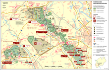
Fortuna (Bergheim)

Fortuna was a district of the city of Bergheim in what is now the Rhein-Erft district (formerly Erftkreis), which fell victim to lignite mining in the mid-1980s .
geography
Fortuna was located between the southern Bergheimer districts Bergheim-Mitte, Kenten , Quadrath-Ichendorf and the northern districts Oberaußem and Niederaußem at an altitude of approx. 110 to 123 meters above sea level south of today's Abtsbusch and the Glessener Höhe and west of the Fischbachhöhe.
history
The Fortuna colony was founded in 1899 not far from the Fortuna briquette factory near Oberaussem . Due to the growing lignite mining in the Rhineland, the workers and their families needed living space. Little by little, the workers' settlement developed into a place with a corresponding infrastructure.
With the expansion of the briquette factory and, from 1910, the Fortuna power station , more and more people moved into the village. A school was established and in the 1920s the Catholic Church, consecrated to Saint Barbara, was established. Almost 2,000 people lived in the town during the economic miracle.
politics
Administratively, the place belonged to the municipality of Oberaußem-Fortuna , which was incorporated into the district town of Bergheim on January 1, 1975 by the Cologne Act .
Relocation
In the 1970s, the resettlement measures began as part of the exploration work for the Bergheim opencast mine . Most of the "Fortunese" moved into company apartments in the surrounding towns or built new ones in Oberaussem.
The Fortuna power plant also fell victim to mining . In 1989, the demolition work began. The Niederaussem power plant was expanded for the demolished Fortuna power plant .
Memorials
The demolished steeple of the Barbarakirche and the Barbara chapel on Ernst-Reuter-Ring, which was built on the private initiative of the current mayor of Oberaussem, Willi Weck, are reminiscent of the former location of the Vinzentius Church in Oberaussem. Many Fortunese found their new home in the immediate vicinity of the chapel.
In 2012, donated by RWE, a wayside shrine with a figure of Saint Barbara was erected on the site of the former location and consecrated by the Oberaußem clergy of both denominations, which will be looked after by the St. Vinzentius Schützenbruderschaft in future.
future
The Bergheim open-cast mine was charred and was recultivated until 2012 . Resettlement of the former Fortune site is not planned. The development of arable land and a local recreation area are planned . In addition, the extension of the L276 (formerly the K22 district road ) as a connecting road between the Bergheim-Kenten and Bergheim-Oberaußem locations is currently being planned.
literature
- Detlef Witt: The Fortuna power plants
Web link
Individual evidence
- ↑ Martin Bünermann, Heinz Köstering: The communities and districts after the municipal territorial reform in North Rhine-Westphalia . Deutscher Gemeindeverlag, Cologne 1975, ISBN 3-555-30092-X .
- ↑ Stefanie Stockem: Remembrance of Fortuna Kölner Stadt-Anzeiger, Rhein-Erft of October 15, 2012, p. 35
Coordinates: 50 ° 57 ′ 51.3 " N , 6 ° 40 ′ 17.5" E


