Frankenforst (Lückerath)
|
Frankenforst
City of Bergisch Gladbach
Coordinates: 50 ° 57 ′ 55 ″ N , 7 ° 8 ′ 37 ″ E
|
||
|---|---|---|
|
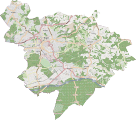
Location of Frankenforst in Bergisch Gladbach |
||
Frankenforst was a district in what is now the Lückerath district of the city of Bergisch Gladbach in the Rheinisch-Bergisches Kreis . The name goes back to the surrounding forest area Frankenforst , which was used as a ban forest in turn for hunting by the earlier kings of the Franks.
Today's Frankenforst district , which emerged much later to the southeast, is also named after the forest area .
Location and description
The village of Frankenforst was south of the center of Lückerath and east of the Cologne-Mülheim-Lindlar railway line . Today there are Hans-Böckler-Strasse and Graf-von-Spee-Strasse.
history
The place is recorded on the topographical survey of the Rhineland from 1824 as Frankenforst . From the Prussian new recording from 1892 he is on Ordnance Survey regularly until 1941 as Frankenforst listed or with no name. Later, after the Second World War , the entire surrounding area was rebuilt and fully developed. Nothing has been preserved from the original development.
Frankenforst belonged to the mayor's office of Bensberg and denominationally to the parish of Bensberg. Due to the Cologne Act , the city of Bensberg was merged with Bergisch Gladbach to form the city of Bergisch Gladbach with effect from January 1, 1975. The Frankenforst area also became part of Bergisch Gladbach.
| year | Residents | Residential buildings | category |
|---|---|---|---|
| 1822 | 4th | Farm | |
| 1830 | 6th | Farm | |
| 1845 | 7th | 1 | Farmer good |
| 1871 | 13 | 2 | Yard |
| 1885 | 26th | 3 | Locality |
| 1895 | 22nd | 3 | Locality |
| 1905 | 53 | 7th | Locality |
Individual evidence
- ^ Andree Schulte, Bergisch Gladbach, city history in street names , published by the Bergisch Gladbach city archive, volume 3, and by the Bergisches Geschichtsverein department Rhein-Berg e. V., Volume 11, Bergisch Gladbach 1995, pp. 288 f., ISBN 3-9804448-0-5
- ↑ Alexander A. Mützell: New topographical-statistical-geographical dictionary of the Prussian state . tape 1 . Karl August Künnel, Halle 1821.
- ↑ Friedrich von Restorff : Topographical-statistical description of the Royal Prussian Rhine Province , Nicolai, Berlin and Stettin 1830
- ↑ Overview of the components and list of all the localities and individually named properties of the government district of Cologne: by districts, mayor's offices and parishes, with information on the number of people and the residential buildings, as well as the Confessions, Jurisdictions, Military and former state conditions. / ed. from the Royal Government of Cologne [Cologne], [1845]
- ↑ Royal Statistical Bureau Prussia (ed.): The communities and manor districts of the Prussian state and their population . The Rhine Province, No. XI . Berlin 1874.
- ↑ Königliches Statistisches Bureau (Prussia) (Ed.): Community encyclopedia for the Rhineland Province, based on the materials of the census of December 1, 1885 and other official sources, (Community encyclopedia for the Kingdom of Prussia, Volume XII), Berlin 1888.
- ↑ Königliches Statistisches Bureau (Prussia) (Ed.): Community encyclopedia for the Rhineland Province, based on the materials of the census of December 1, 1895 and other official sources, (Community encyclopedia for the Kingdom of Prussia, Volume XII), Berlin 1897.
- ↑ Königliches Statistisches Bureau (Prussia) (Ed.): Community encyclopedia for the Rhineland Province, based on the materials of the census of December 1, 1905 and other official sources, (Community encyclopedia for the Kingdom of Prussia, Issue XII), Berlin 1909.
