Franklin, New Hampshire
| Franklin | ||
|---|---|---|
|
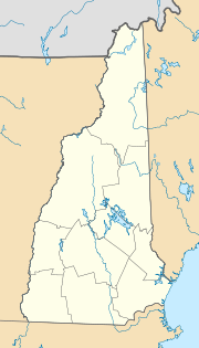
Location in New Hampshire
|
||
| Basic data | ||
| Foundation : | 1764 | |
| State : | United States | |
| State : | New Hampshire | |
| County : | Merrimack County | |
| Coordinates : | 43 ° 27 ′ N , 71 ° 39 ′ W | |
| Time zone : | Eastern ( UTC − 5 / −4 ) | |
| Residents : | 8,447 (as of 2016) | |
| Population density : | 118.3 inhabitants per km 2 | |
| Area : | 75.5 km 2 (approx. 29 mi 2 ) of which 71.4 km 2 (approx. 28 mi 2 ) is land |
|
| Height : | 94 m | |
| Postal code : | 03235 | |
| Area code : | +1 603 | |
| FIPS : | 33-27380 | |
| GNIS ID : | 0873290 | |
| Website : | www.franklinnh.org | |
| Mayor : | Ken Merrifield | |
Franklin is a town ( city ) in the State of New Hampshire . It has a population of around 8,400 (2016 estimate, US Census Bureau ) and is located in Merrimack County . West Franklin is also part of the city .
geography
The city has an area of 75.5 km², of which 71.4 km² are land and 4.1 km² (5.45%) are water. The city is located in the catchment area of the Winnipesaukee , Pemigewasset, and Merrimack River rivers . The Webstersee is located in the northern part of the city . An unnamed hill in the northeastern urban area with a height of 418 m is Franklin's highest mountain.
history
In 1764 the place was settled and was originally called Pemigewasset Village . The place was renamed in 1820 in honor of Benjamin Franklin . In 1828 Franklin was promoted to a town and in 1895 to a city .
