Franzensfester reservoir
| Franzensfester reservoir | |||||||||
|---|---|---|---|---|---|---|---|---|---|
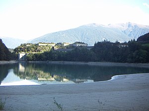
| The reservoir with the fortress Franzensfeste | |||||||||
|
|||||||||
|
|
|||||||||
| Coordinates | 46 ° 46 '54 " N , 11 ° 37' 14" E | ||||||||
| Data on the structure | |||||||||
| Construction time: | 1939/40 | ||||||||
| Height above the river bed : | 58.8 m | ||||||||
| Data on the reservoir | |||||||||
| Altitude (at congestion destination ) | 723 m | ||||||||
| Water surface | 23 hectares | ||||||||
| Storage space | 3.35 million m³ | ||||||||
The Franzensfester Stausee (also Franzensfester See or Unterauer Stausee , Italian Lago di Fortezza ) is located in the lower Wipptal in South Tyrol ( Italy ). The Eisack is dammed in it for the purpose of generating electricity. Most of the water is in the area of the municipality of Franzensfeste , smaller parts in the southeast in that of the municipality of Natz-Schabs .
history
In 1939 the fascist rulers ordered the construction of the reservoir at the Fortezza Fortress due to the increased demand for energy and the desire for self-sufficiency in electricity generation . To make this possible, the hamlet of Unterau and the old Ladritscher bridge had to be abandoned. At the same time, the Mühlbach reservoir was built at the entrance to the Puster Valley . The water from both lakes feeds the power plant in nearby Brixen through pressure pipes .
Technical specifications
The reservoir is about 23 hectares and a maximum of 58.8 m deep. The height of the storage target is 723 m . The lake holds about 3.35 million m³.
Individual evidence
- ↑ Franzensfester Reservoir. sentres.com, accessed November 26, 2012 .
- ↑ Ladritsch Bridge. "Topic portal 1809" of the state library "Dr. Friedrich Teßmann ” , accessed on November 26, 2012 .
- ^ Reservoirs in South Tyrol in the portal of the South Tyrolean provincial administration
- ↑ Fortezza. Limno - Banca dati dei laghi italiani, accessed on November 26, 2012 .


