Fuorcla Tschüffer
| Fuorcla Tschüffer | |||
|---|---|---|---|
|
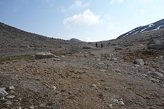
Fuorcla Tschüffer from the west |
|||
| Compass direction | west | east | |
| Pass height | 2832 m above sea level M. | ||
| Canton | Graubünden , Switzerland | ||
| expansion | trail | ||
| Mountains | Livigno Alps | ||
| map | |||
|
|
|||
| Coordinates | 795 673 / 149 981 | ||
The Fuorcla Tschüffer is an alpine pass in the canton of Graubünden in the Swiss Alps . With a peak height of 2832 m above sea level. M. it connects the plateau S-chüdella in the west with the Val Tschüffer in the east. The pass is located between Piz Pischa in the north and Piz dal Fain in the south. The top of the pass is very attractive with its little lakes, rubble and firn terraces.
Location and surroundings

The Fuorcla Tschüffer belongs to the Piz Languard group, a subgroup of the Livigno Alps . The pass is located entirely in the municipality of Pontresina . Fuorcla Tschüffer is the west by the high-level S-chüdella with the mountain as Pischa Lej and the east by the Val Tschüffer the mountain lake Lej Tschüffer edged. The pass connects Piz Pischa ( 3136 m ) in the north with Piz dal Fain ( 2907 m ) in the south.
In close proximity is the Fuorcla Pischa ( 2847 m ), the transition to Val Languard in the west, the Fuorcla Prüna ( 2835 m ), the transition to Val Prüna in the northwest, and the Fuorcla Prünella ( 2825 m ), the transition to Val Prünella in the East.
The valley location and frequent starting point is Bernina Suot.
Routes to the pass
By Bernina Suot
- Starting point: Bernina Suot ( 2045 m )
- Via:
- Alp Bernina, Val Pischa, Lej da Pischa
- Alp Bernina, Val Tschüffer, Lej Tschüffer
- Difficulty:
- Time required:
- 2 ¾ hours via Val Pischa
- 3 ½ hours over Val Tschüffer
From Pontresina
- Starting point: Pontresina ( 1805 m ) or Alp Languard ( 2327 m )
- Via: Plaun da l'Esen, Fuorcla Pischa ( 2847 m ), Lej da Pischa ( 2770 m )
- Difficulty: EB , as trail white-red-white marks
- Time required: 5 hours from Pontresina or 3½ hours from Alp Languard
From Muottas Muragl
- Starting point: Muottas Muragl ( 2454 m )
- Via: Segantinihütte ( 2732 m ), Plaun da l'Esen, Fuorcla Pischa ( 2847 m ), Lej da Pischa ( 2770 m )
- Difficulty: EB , as trail white-red-white marks
- Time required: 5 hours
From La Punt-Chamues-ch
- Starting point: La Punt-Chamues-ch ( 1708 m )
- Via:
- Val Chamuera, Val Prüna, Fuorcla Prüna ( 2835 m ), Lej da Pischa ( 2770 m )
- Val Chamuera, Alp Prünella, Fuorcla Prünella ( 2825 m ), Lej Tschüffer ( 2751 m )
- Difficulty:
- Time required:
- 5 ½ hours via Fuorcla Prüna
- 6 hours via Fuorcla Prünella
Web links
- www.hikr.org Various tour reports
literature
- Bernard Condrau, Walter Candinas: club guide, Bündner Alps . Middle Engadine and Poschiavo. 2nd Edition. tape X . Verlag des SAC, 1984, ISBN 3-85902-039-0 , p. 164 .
- National map of Switzerland, sheet 1258 La Stretta, 1: 25,000, Federal Office of Topography, 2015 edition.

