Gasadalur
|
||

|
||
| position | 62 ° 7 ' N , 7 ° 26' W | |
|
Resident rank |
18 (2012) - |
|
| Commune | Sørvágur | |
| Post Code | FO 387 | |
| Markatal | - | |
|
Grammar dative (in / from ...) genitive (after ...) |
- - |
|


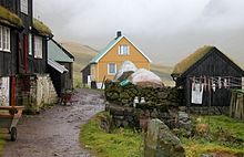
Gásadalur [ ˈgɔaːsaˌdɛaːlʊɹ ] "Goose Valley" ( Danish : Gåsedal ) is a place in the Faroe Islands in the west of the island of Vágar . Until the beginning of the 21st century, it was considered one of the most isolated places in Europe, as the village could only be reached on foot or by helicopter. This changed when the Gásadalstunnel was opened in 2003 .
geography
Gásadalur belonged to the now dissolved Bíggjar Kommuna until the end of 2004 . It is located high above the sea on the west coast of Vágar. It meets the Mykinesfjørður and is surrounded by the highest mountains on Vágar: in the north by 722 m high Árnafjall and in the east by 715 m high Eysturtindur . To the south the view opens up to the islands of Tindhólmur and Gáshólmur .
The landing stage has always been inconvenient, which is why the inhabitants have always kept their fishing boats near Bøur . However, during the British occupation of the Faroe Islands in World War II , a staircase was built that leads down to the sea in 1940.
Traditionally, the path to the outside world only leads over the arduous path over a mountain pass at a height of more than 400 m. Later an Atlantic Airways helicopter operated .
There is no church in the village. The old school now serves as a community center.
history
A legend tells that the name of the place is related to a woman from Kirkjubøur named Gæsa. She ate meat during Lent, which was sacrilege. She got all of her property and then settled in this valley on Vágar, which was named after her. Other local sagas are mostly about elves.
It is more likely that the name comes from the geese that live here. Gásadalur translated means goose valley.
Before the cemetery was established in 1873, the dead were carried over the pass to Bøur, where they were buried. The Líkusteinurin ( English corpse stone ) still points to this fact today .
tourism
The old hiking trail from Bøur to Gásadalur is now primarily of tourist interest. The 3.5 km long tour takes about 2½ hours and is classified as difficult. The first part of the trail runs right along the edge of the mountain and offers a view of Sørvágsfjørður , Tindhólmur , Gáshólmur and Mykines . The descent into the village is steep and there are warnings about loose stones.
See also: List of cities and towns in the Faroe Islands
Films and literature
-
1700 meters from the future . Denmark 1990, 84 min, documentary film. Director: Ulla Boje Rasmussen . (Info)
- 1700 meters from the foreign tides: a film about the færøske bygd Gásadalur . Statens Filmcentral, Copenhagen 1990. - 32 p. (Booklet)
- Vilhelm Johannesen: The postal history of Gásadalur. . In: News from the Faroe Islands. Postverk Føroya , 3/2003 .. April 26, 2007. Archived from the original on September 30, 2007.
Web links
- Faroestamps.fo - Gásadalur (partly based on this article)
- Faroeislands.dk: Gasadalur (in English. Info and photos)

