
Gänsedrecksee
| Gänsedrecksee and Kuhunter | ||
|---|---|---|

|
||
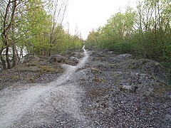
| Gänsedrecksee, view towards the north shore | ||
| Geographical location | Binsfeld , Speyer , Rhineland-Palatinate , Germany | |
| Tributaries | Groundwater | |
| Drain | none | |
| Data | ||
| Coordinates | 49 ° 21 '27 " N , 8 ° 27' 34" E | |
|
||
| length | 1.7 km | |

|
||
| Usage regulations for Silbersee, Binsfeld, Gänsedrecksee and Kuhunter; yellow: beaches / area for bathers; blue: swimming allowed; orange: nature reserve; purple: surfing; pink: parking lot | ||

The Gänsedrecksee and the Kuhunter are the two easternmost lakes of the eight lakes in the Binsfeld that were dredged for the purpose of gravel extraction . They are located in the northernmost part of the Rhine lowlands of Speyer and belong to the Speyer-Nord district .
Both lakes, the Gänsedrecksee to the north (first east of the Silbersee , then east of the Binsfeld lake) and the southern Kuhunter, have merged into a lake by dredging away the dividing headland.
The Kuhuntersee is not only the southern continuation of the Gänsedrecksee, it also bulges to the west to south of the Binsfeld lake. The Kuhunter is separated from the lake Binsfeld by a headland that has become an island through two punctures, a small one on the west bank and a larger one on the east. On this peninsula / island is swimming allowed.
The banks of the Gänsedrecksee are entirely dedicated to nature conservation , but are also used for swimming.
Along the east bank of Gänsedrecksee and Kuhunter (which have merged) a dense wood has been created for nature conservation purposes . Behind the wood there is a narrow strip of fields in the south and then an asphalt field path, which is also used as a cycle path for the Rhine route, and then the main Rhine dike on which District Road 2 runs.
The boundary between Speyer and Otterstadt runs north of the Gänsedrecksee .
The south bank of the Kuhunter is also dedicated to nature conservation. Nevertheless, the area is also used for swimming.
In the southwest corner of the Kuhunter there is an entry point for divers and the club bar "Anglerstubb" of a fishing club .
Diving
Only these two lakes are approved for diving with equipment. The contingent is 20 divers on the day of 1.6. until 14.10 each year. In addition to the entrance next to the Anglerstubb in the southwest of the Kuhunter, there is a signposted entrance on the northwest bank of the Gänsedrecksee.
rowing
In the Kuhunter, where bathing is not permitted, rowing is permitted outside the closed season. The closed season lasts from October 15th to May 31st of each year. When rowing, a distance of 30 meters to the bank must be kept.
Surroundings
South of the Kuhunter there is a closed field path between Anglerstubb and Kreisstraße 2. South of the southwest corner of the Kuhunter there is a triangle between this field path, the K2 and the embankment of the federal motorway 61 with the Binshof rest area. There is arable farming.
To the south of the point where the dirt road meets the K2 and thus the main Rhine dike, there is a pumping station in this triangle for draining the northern Rhine lowlands from Speyer.

View from the middle west bank to the south east bank

View from the central west bank to the southeast
Headland between Gänsedrecksee and Lake Binsfeld


Individual evidence
- ↑ Archive link ( Memento of the original dated November 30, 2011 in the Internet Archive ) Info: The archive link was inserted automatically and has not yet been checked. Please check the original and archive link according to the instructions and then remove this notice.
See also
Web links
- Aerial view of the lakes - very easy to see, the motorway with a rest area as the southern border of the area, south of the double lake Kuhunter / Gänsedreck and the arch of Hochgestade and Kreisstraße 2, which trace the course of an old arch of the Rhine.
- The city administration of Speyer on the common use of the Binsfeld (swimming, diving, rowing, surfing)
- Website of the fishing club that leased the area
- To the underwater world in the Kuhuntersee and Gänsedrecksee