Gascoyne River
| Gascoyne River | ||
|
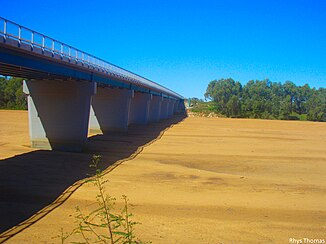
River bed of the Gascoyne River at Carnarvon |
||
| Data | ||
| location | Western Australia , Australia | |
| River system | Gascoyne River | |
| Drain over | Gascoyne River → Indian Ocean | |
| source | Robinson Ranges 24 ° 46 ′ 4 ″ S , 116 ° 15 ′ 42 ″ E |
|
| Source height | 514 m | |
| muzzle | at Carnarvon in the Indian Ocean Coordinates: 24 ° 52 '0 " S , 113 ° 38' 0" E 24 ° 52 '0 " S , 113 ° 38' 0" E |
|
| Mouth height | 0 m | |
| Height difference | 514 m | |
| Bottom slope | 0.53 ‰ | |
| length | 978 km | |
| Catchment area | 26,381 km² | |
| Left tributaries | Gascoyne River Middle Branch, Coodewa Creek, Nanular Creek, Moorayana Creek, Landor River , Shea Creek, Minindi Creek, Wabli Creek, Dellas Creek, Chalba Creek, Mombo Creek, Nine Mile Creek, Dalgety Brook, Geeranoo Creek, Congo Creek, Pell Creek , Salt Gully, Jacobs Gully, Lewes Creek | |
| Right tributaries | Gascoyne River North Branch, Turner Creek, Deverell Creek, Sullivan Creek, Coombrico Creek, Aurillia Creek, Biddenew Creek, Mount Gascoyne Creek, Madonga Creek, Mount James Creek, Codra Creek, Thomas River , Doweranin Creek, Thirty-One River , Cream Creek , Lyons River , Mooka Creek | |
| Flowing lakes | Tibingoona Pool , Bibbingoona Pool , Nungamarra Pool , Mibbley Pool , Mutherbukin Pool , Beelu Pool , Bilyarra Pool , Piddendoora Pool , Gnardune Pool | |
| Medium-sized cities | Carnarvon | |
| Small towns | Gascoyne Junction | |
| Communities | Landor, Yinnetharra, Bidgemia, Mooka, Doorawarrah, Brickhouse | |
The Gascoyne River is a river in the Australian state of Western Australia .
At 978 km, it is the longest river in the state.
geography
River course
The river rises on the slopes of Wilgoona Hill in the Robinson Ranges west of the Gibson Desert and flows into Shark Bay and thus into the Indian Ocean at Carnarvon .
The Gascoyne River is composed of two arms:
- The Gascoyne River North Branch is the northern 125 km long arm and has its source near the Collier Range
- The Gascoyne River Middle Branch is the southern, 15 km long arm and has its source at the settlement Doolgunna .
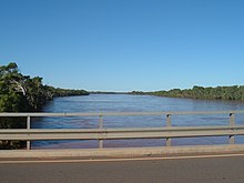
The Gascoyne River is also known as the “reverse flow” because it only has visible water for about 120 days a year and flows underground for the rest of the year. This is due to a huge, natural water retention system, the aquifers of which lie under the desert sand.
The river flows through a thinly vegetated landscape, which is mainly used for gold mining and sheep farming. It flows through many pools, which serve as an important source of water for both wild and farm animals.
Tributaries with mouth heights
The most important tributary is the 561 km long Lyons River , which meets the Gascoyne River at Gascoyne Junction about 160 km above the confluence with Shark Bay. Together, these two rivers have a catchment area of 68,326 km², which lies completely east of the Kennedy Ranges and extends about 480 km inland.
- Gascoyne River North Branch - 514 m
- Gascoyne River Middle Branch - 514 m
- Coodewa Creek - 491 m
- Turner Creek - 456 meters
- Deverell Creek - 453 m
- Nanular Creek - 410 m
- Sullivan Creek - 406 m
- Coombrico Creek - 376 m
- Aurillia Creek - 366 m
- Moorayana Creek - 352 m
- Landor River - 346 m
- Biddenew Creek - 331 m
- Mount Gascoyne Creek - 327 m
- Shea Creek - 318 m
- Madonga Creek - 310 m
- Mount James Creek - 308 m
- Minindi Creek - 304 m
- Wabli Creek - 303 m
- Codra Creek - 294 m
- Thomas River - 294 m
- Dellas Creek - 291 m
- Doweranin Creek - 284 m
- Thirty-One River - 259 m
- Coomberoo Creek - 252 m
- Chalba Creek - 235 m
- Mombo Creek - 233 m
- Nine Mile Creek - 228 m
- Dalgety Brook - 210 m
- Geeranoo Creek - 194 m
- Congo Creek - 193 m
- Pell Creek - 180 m
- Cream Creek - 153 m
- Lyons River - 138 m
- Salt Gully - 122 m
- Mooba Creek - 109 m
- Jacobs Gully - 105 m
- Lewes Creek - 10 m
Flowing lakes
- Tibingoona Pool - 506 m
- Bibbingoona Pool - 496 m
- Nungamarra pool - 483 m
- Mibbley Pool - 450 m
- Mutherbukin Pool - 301 m
- Beelu Pool - 229 m
- Bilyarra Pool - 226 m
- Piddendoora pool - 154 m
- Gnardune Pool - 132 m
Origin of name
The river was named after "my friend, Captain J. Gascoyne (Royal Navy)" by the explorer Lieutenant George Gray , who discovered it in 1839.
Flood in December 2010
The December 2010 floods are believed to be the most devastating ever recorded. The extent and scope of the flooding posed major problems for the region.
See also
Web links
Individual evidence
- ↑ a b c d e Map of Gascoyne River . Bonzle.com
- ^ Gascoyne River . Total Travel (2006) ( Memento of the original from November 18, 2008 in the Internet Archive ) Info: The archive link was inserted automatically and has not yet been checked. Please check the original and archive link according to the instructions and then remove this notice.
- ↑ Landgate - History of River Names - G . (2008) ( Page no longer available , search in web archives ) Info: The link was automatically marked as defective. Please check the link according to the instructions and then remove this notice.
- ↑ Massive Damage from 'Worst ever' Floods . ABC News (December 21, 2010)
- ^ Government Warned About Flood Potential . ABC News (December 22, 2010)

