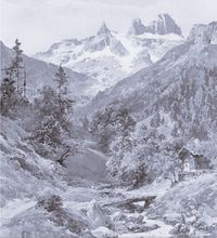
Gauertal
Coordinates: 47 ° 2 ′ 0 ″ N , 9 ° 50 ′ 0 ″ E
The Gauertal is a high mountain valley on the northern slope of the Rätikon in the municipality of Tschagguns .
topography

It is located in Vorarlberg and is a valley of the Montafon . The valley is traversed by the mountain river Rasafei .
geology
In a small area, the valley from Latschau to Lindauer Hütte is crossed by various geological units of the Eastern Alpine nappes ( Northern Limestone Alps and Old Crystalline ) in the Rätikon. Due to its location in a tectonic border area, the geology of this area is broken up into individual blocks - combined with faults, shear fissures and fractures.
colonization
The Gauertalhaus der Naturfreunde is located in the lower part of the Gauertal . The Alpe Latschätz , the upper and lower Sporaalpe and the two Maisäß settlements of Plazadels and Wachters Dieja are located in the Gauertal . In the middle is the Lindauer Hütte at 1744 m as the starting point for the Drusenfluh ( 2827 m ), the Three Towers ( 2830 m ) and the Sulzfluh ( 2818 m ).
literature
- Barbara Keiler, Klaus Pfeifer (eds.): Plazadels and Wachters Dieja. Maisäß settlements in the Gauertal. Heimatschutzverein im Tale Montafon , Schruns 2001, ISBN 3-901833-13-7 .

