Gelmke
| Gelmke | ||
|
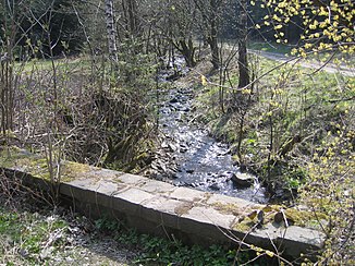
The Gelmke above the intersection with the E 11 long-distance hiking trail |
||
| Data | ||
| Water code | DE : 482148 | |
| location | Lower Saxony , Germany | |
| River system | Weser | |
| Drain over | Abzucht → Oker → Aller → Weser → North Sea | |
| source | 1.45 km east-north-east. from the thick head in the Harz Mountains 51 ° 52 ′ 19 ″ N , 10 ° 26 ′ 36 ″ E |
|
| Source height | approx. 532 m above sea level NHN | |
| muzzle | at Oker in the breeding coordinates: 51 ° 54 ′ 36 " N , 10 ° 28 ′ 27" E 51 ° 54 ′ 36 " N , 10 ° 28 ′ 27" E
|
|
| length | 5 km | |
| Catchment area | 4.6 km² | |
| Right tributaries | nameless brook on the Brautstein | |
The Gelmke is an approximately 5 km long river in Lower Saxony that rises in the Gelmke valley. The small stream flows through part of the Oker district (Goslar) where it flows to the breeding area.
geography
The Gelmke rises in the upper Gelmketal at an altitude of about 610 m above sea level. NN . The source is east-northeast of the Dicken Kopf (668 m) and north of the Eichenberg (670 m). From here the stream first flows in a northerly direction through a densely wooded valley. It is crossed by the European long-distance hiking trail E11 before it swings to the east in open fields above the former Goslar clarification ponds. Shortly afterwards it turns north and ends at the train station in Goslar-Oker in the Abzucht.
Individual evidence
- ↑ a b State Office for Geoinformation and Land Surveying Lower Saxony: Top 50 - Topographic Map 1: 50,000 Lower Saxony / Bremen , as of 2000.
- ↑ NLWKN : Water quality report Oker 2002 , Braunschweig October 2002, p. 31
- ↑ a b Bad Harzburg, Goslar, Altenau with Brocken. 5th edition, Publicpress, Geseke. ISBN 978-3-89920-069-0 .
