
Giebichenstein (Stöckse)

The Giebichenstein in the "Krähe" state forest near Stöckse is one of the largest boulders in northern Germany . The 330 tons of heavy stone granite is 7.5 m long, 4.5 m wide and 2.75 m high. An image of the Giebichenstein is part of the coats of arms of Stöckse and the joint municipality of Steimbke in Lower Saxony . In the immediate vicinity of the stone is the large stone grave devil's bed .
description
It is believed that the stone was deposited as part of a moraine during the Saale Ice Age around 250,000 years ago. During an excavation at the foot of the stone in 1967, around 300 objects such as knives and flint blades were found . It was the remains of a stone age hunter camp . Other prehistoric sites nearby are a Bronze Age barrow field around 1,700 BC. Due to the concentration of historical places, the first archaeological hiking trail in Lower Saxony was created here in 1978, which is one kilometer long and includes three stations (large stone grave, hunter camp, barrow field).
Say to the stone
The forecast for the headquarters was located under the stone once a dwarf king called Giebich . When the giant Hans Lohe from the Grinderwald wanted to smash the Wölper church tower out of anger , it was Giebich who, with his secret powers, forced the big, heavy stone on the ridge of the crow to the ground. It is still there today; it is called, after the kind Giebich, who protected people against all evil forces, "Giebichenstein" - in the dialect of the region "Gewekenstein".

Stone on the coat of arms of the municipality of Steimbke
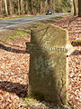
Stone reference to the Giebichenstein

Information board on the archaeological hiking trail, behind the Giebichenstein

Straight sidewall of the stone

Stone on the coat of arms of Stöckse


literature
- Ernst Andreas Friedrich : Natural monuments of Lower Saxony . Hanover 1980, ISBN 3-7842-0227-6
- Walter Nowothnig : The Giebichenstein near Stöckse, Nienburg / W district. and the prehistoric monuments (= guide to the prehistory and early history of Lower Saxony, volume 6), Hildesheim: Lax, 1973
Web links
- Description with photo and map by the State Office for Mining, Energy and Geology in Lower Saxony, (pdf)
- Description at steinzeugen.de
- Ice age hunters on the Giebichenstein
Coordinates: 52 ° 37 ′ 58.8 ″ N , 9 ° 18 ′ 52.63 ″ E