Gjende
| Gjendesee | ||
|---|---|---|

|
||
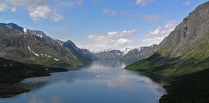
| Gjendesee, looking west | ||
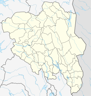
| Geographical location | Innlandet , Norway | |
| Tributaries | Storåe, Veslåe, Muru, Leirungsåe | |
| Drain | Sjoa → Lågen | |
| Data | ||
| Coordinates | 61 ° 29 ′ N , 8 ° 38 ′ E | |
|
|
||
| Altitude above sea level | 984 m | |
| length | 18 km | |
| width | 1 km | |
| Maximum depth | 149 m | |
The Gjende is nestled between steep mountain slopes in the eastern Jotunheimengebiet in the Norwegian municipality Vågå in the province Innlandet .
On the north bank are the steep walls of the Vesslefjell ( 1743 m ), the Besseggengrat and the Memurutunga. A popular hiking trail leads over the Besseggengrat, from which one has a beautiful view of the Gjendesee and the surrounding mountainous landscape. The south bank is made up of almost vertically sloping slopes of Knutsholtind ( 2341 m ), Tjönnholstind ( 2331 m ) and Bukkehåmåren ( 1910 m ). Due to the steep bank slopes and its elongated shape, the Gjendesee looks like a fjord .
From the glacier flows Muru and Storåe by grinding the debris material (is moraine formed) glacier milk transported into the lake and gives the Gjende its striking emerald green color.
At the eastern end is the DNT hut Gjendesheim , about in the middle on the north bank is the private hut Memurubu and at the western end the DNT hut Gjendebu . Boats run regularly between the three huts in summer. A tour on one of these ships takes about two hours.


