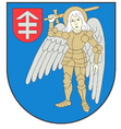
Gmina Kodeń
| Gmina Kodeń | ||
|---|---|---|

|
|
|
| Basic data | ||
| State : | Poland | |
| Voivodeship : | Lublin | |
| Powiat : | Bialski | |
| Geographic location : | 51 ° 55 ' N , 23 ° 36' E | |
| Residents : | see Gmina | |
| Postal code : | 21-509 | |
| Telephone code : | (+48) 83 | |
| License plate : | LBI | |
| Gmina | ||
| Gminatype: | Rural community | |
| Gmina structure: | 20 localities | |
| 19 school authorities | ||
| Surface: | 150.33 km² | |
| Residents: | 3553 (Jun. 30, 2019) |
|
| Population density : | 24 inhabitants / km² | |
| Community number ( GUS ): | 0601062 | |
| administration | ||
| Address: | ul. 1 Maja 20 21-509 Kodeń |
|
| Website : | www.koden.pl | |
The Gmina Kodeń is a rural community in the Powiat Bialski of the Lublin Voivodeship in Poland . Your seat is the village of the same name with about 1800 inhabitants.
geography
The most important body of water of the Gmina is the Bug , which forms the border with Belarus .
structure
The following 16 villages with 19 school authorities ( sołectwo ) belong to the rural community (gmina wiejska) Kodeń :
- Dobratycze
- Dobromyśl
- Elżbiecin
- Kąty
- Code I
- Code II
- Code III
- Kopytów
- Kopytów-Kolonia
- Kostomłoty I
- Kostomłoty II
- Kożanówka
- Okczyn
- Olszanki
- Szostaki
- Zabłocie
- Zabłocie-Kolonia
- Zagacie
- Zalewsze
Other localities are:
Dobratycze (osada), Kostomłoty (osada), Haczki and Rapcze.
Web links
Commons : Gmina Kodeń - collection of pictures, videos and audio files
- Community website (Polish)
Individual evidence
- ↑ population. Size and Structure by Territorial Division. As of June 30, 2019. Główny Urząd Statystyczny (GUS) (PDF files; 0.99 MiB), accessed December 24, 2019 .
