Goat Rocks Wilderness
|
Goat Rocks Wilderness
|
||
|
Goat Rocks Wilderness, with the Mount Adams massif in the background |
||
| location | Yakima County / Lewis County , Washington , USA | |
| surface | 437.45 km² | |
| WDPA ID | 368988 | |
| Geographical location | 46 ° 31 ' N , 121 ° 27' W | |
|
|
||
| Setup date | 3rd September 1964 | |
| administration | US Forest Service | |
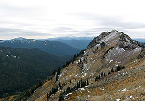
The Goat Rocks Wilderness is a wilderness area in the US state of Washington on the main ridge of the Cascade Mountains south of US Highway 12 . It consists of nearly 440 square kilometers of Mount Baker-Snoqualmie National Forest and the Gifford Pinchot National Forest . Its main feature is a series of bizarre peaks, the Goat Rocks , which are named for the large number of mountain goats that live in the area . The closest city is Yakima .
geography
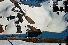
More than two million years ago, a volcano 3,700 meters high dominated this landscape. The eroded remains of this volcano consist of jagged peaks, the mean height of which is over 2,100 meters. Its highest point is Gilbert Peak (2,494 meters), which rises over 1,100 meters above the area. The Packwood , McCall , Conrad and Meade glaciers are located on the shady northern slopes . The wilderness area is drained by the North and South Forks of the Tieton , Cispus and Cowlitz Rivers and their tributaries. The lowest point of the area is near Packwood Lake at 890 meters.
history
The importance of the Goat Rocks wilderness area was first recognized on February 13, 1931, when approximately 180 km² were designated as the original area by the Forest Service of the US Department of Agriculture . In 1935 this area was expanded to 293 km², and in 1940 it was expanded again to 335 km². The area has been designated as a Goat Rocks Wild Area by the head of the Forest Service. With the passage of the Wilderness Act by the United States Congress on September 3, 1964, the area was declared a wilderness area and thus part of the National Wilderness Preservation System . Congress added another area in 1984. The Forest Service is tasked with maintaining and promoting the wilderness character through its management and at the same time making the area accessible to the public for use and enjoyment.
recreation
The Pacific Crest Trail (PCT), which stretches from Canada to Mexico, runs through the middle of the Goat Rocks Wilderness. The section of this trail, which runs through Washington State, was once known as the Washington Cascade Crest Trail and was completed in 1935. The National Trail System Act of 1968 made it part of the PCT. The Yakama Indian Reservation , which borders the wilderness area in the southeast, is closed to the public with the exception of the PCT sections.
Individual evidence
- ↑ Goat Rocks Wilderness . In: Wilderness.net . University of Montana. Retrieved March 26, 2015.
- ↑ Wilderness: Goat Rocks . In: Gifford Pinchot National Forest . US Forest Service. Retrieved March 26, 2015.
- ↑ a b Goat Rocks Wilderness . In: Gifford Pinchot National Forest . US Forest Service. Retrieved April 2, 2015.
Web links
- Goat Rocks Wilderness . US Forest Service website
- Goat Rocks Wilderness . Wilderness.net - a project of the University of Montana (English)
- Walking on the Goat Rocks Crest Trail (English)


