
Cispus River
| Cispus River | ||
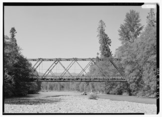 Bridge on Forest Service Road 2306 |
||
| Data | ||
| location | Lewis County / Skamania County , Washington , USA | |
| River system | Columbia River | |
| Drain over | Cowlitz River → Columbia River → Pacific | |
| Source in the cascade chain |
Goat Rocks Wilderness 46 ° 29 ′ 41 ″ N , 121 ° 25 ′ 45 ″ W. |
|
| Estuary into Lake Scanewa |
Cowlitz River Coordinates: 46 ° 28 '35 " N , 122 ° 5' 39" W 46 ° 28 '35 " N , 122 ° 5' 39" W. |
|
| Mouth height |
254 m
|
|
| length | 89 km | |
The Cispus River is a river in Lewis and Skamania Counties in Washington state . It is located in the Cascade Mountains , is about 89 km long and flows into the Cowlitz River at Lake Scanewa , the reservoir of the Cowlitz Falls Dam . Its tributaries drain most of south-central and southeastern Lewis County, the far northeast of Skamania County, and parts of western Yakima County .
Its main stream begins in Lewis County in a high glacial valley north of the Snowgrass Flats in the Goat Rocks Wilderness , which is in the Gifford Pinchot National Forest . From here the river flows in a south-westerly direction and takes in the water of several major source rivers such as that of Walupt Creek .
About 65 km before its mouth , the Muddy Fork reaches the Cispus River from the left. The Muddy Fork springs about 11 km from the mouth of the lava glaciers of Mount Adams and after the glacial debris and mud, giving it a muddy (ger .: muddy , named lend) appearance. The Cispus River flows through a wooded valley, most of which was re-grown after the Cispus Burn , a fire in the first decade of the 20th century that struck most of the lower basin.
The fast flowing Canyon Creek flows into the river; it comes from the high altitudes of Mount Adams . A few miles further downstream, the North Fork Cispus River joins the main stream, about 20 miles from its source. From here the Cispus River flows westward and passes campsites and trails in the Gifford Pinchot National Forest . Two tributaries, Yellowjacket Creek and McCoy Creek , flow into the Cispus River from the south about halfway through its course. Then the river passes Tower Rock , a striking quartz-diorite monolith, on its north side. Soon after, the river leaves the Gifford Pinchot National Forest and enters the Weyerhaeuser Cowlitz Tree Farm . The Cispus River ends at the confluence with the Cowlitz River on Lake Scanewa , just above Cowlitz Falls and Riffe Lake .
There is a level that sends its data live to the USGS . The discharge values measured at the river kilometer 28.57 near Randle are as follows:
- Average: 28.3 m³ / s
- Maximum: 277.5 m³ / s
- Minimum: 4.7 m³ / s
Rafting can also be done on the Cispus River .
See also
Individual evidence
- ^ Cispus River in the Geographic Names Information System of the United States Geological Survey
- ↑ a b c United States Geological Survey: United States Topographic Map . TopoQuest. Retrieved January 27, 2013. River kilometers are marked and numbered on the relevant map quadrants.
- ^ Cowlitz Falls Project . Lewis County Public Utility District. Archived from the original on September 29, 2013. Info: The archive link was inserted automatically and has not yet been checked. Please check the original and archive link according to the instructions and then remove this notice. Retrieved January 27, 2013.
- ^ North Fork Cispus River in the Geographic Names Information System of the United States Geological Survey
- ^ Water Resources Data-Washington Water Year 2005; Cowlitz River Basin; 14231900 Cispus River above Yellowjacket Creek, near Randle, WA . United States Geological Survey. Retrieved June 1, 2009.