Lake Gordon (Australia)
| Lake Gordon | |||||||||
|---|---|---|---|---|---|---|---|---|---|
| The 140 m high Gordon dam | |||||||||
|
|||||||||
|
|
|||||||||
| Coordinates | 42 ° 42 '58 " S , 146 ° 10' 21" E | ||||||||
| Data on the structure | |||||||||
| Construction time: | -1974 | ||||||||
| Height of the barrier structure : | 140 m | ||||||||
| Building volume: | 154 000 m³ | ||||||||
| Crown length: | 198 m | ||||||||
| Power plant output: | 432-450 MW | ||||||||
| Data on the reservoir | |||||||||
| Water surface | 281 km² | ||||||||
| Reservoir length | 24 km | ||||||||
| Reservoir width | 21 km | ||||||||
| Storage space | 12.444 million m³ | ||||||||
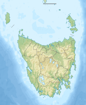
The Lake Gordon is a dam in Australia . It is located on the Gordon River in the southern part of Tasmania, far from major cities.
dam
The dam was built in the early 1970s to generate electrical energy in a hydroelectric power station. The construction was very controversial because a very beautiful natural landscape was dammed, especially the sandy beach at the former Lake Pedder. Lake Gordon is connected to Lake Pedder via the McPartlan Canal , which existed before but is now dammed higher and has an area of 242 km².
Reservoir
The Gordon reservoir has a storage capacity of 12,444 million cubic meters, which is also given as 12,450 or 12,500 million m³. Still other figures speak of 11,900 million m³ of Lake Gordon, to which 3,300 million m³ of Lake Pedder come. That's 25 to 27 times as much water as Sydney Harbor contains. This makes the reservoir, measured in terms of content, the largest in Australia, but only the second largest after Lake Argyle after the area of 281 km² .
Dam wall
The dam , a concrete arch dam , is the fifth tallest in Australia.
Further dams are planned on the lower Gordon River, but they are just as controversial.
Hydroelectric power plant
The hydroelectric power station on the dam is the largest in Tasmania and generates a large part of the electricity there. The cavern in the bedrock has a volume of 67,000 m³. The water runs through a cylindrical opening on an 80 m high intake tower and falls 140 m deep until it reaches the three Francis turbines . The first two generators were put into operation in 1978, the third only in 1988. Each has an output of 144 MW , together 432 or 450 MW. The water then flows back into the Gordon River through a 1.6 km long tunnel.
See also
- List of the largest dams on earth
- List of the largest reservoirs on earth
- List of the largest hydroelectric plants in the world
- List of dams in the world
Web links
- Gordon Power Development ( Memento of October 7, 2007 in the Internet Archive )
swell
- Lake Gordon - TAS . ExplorOz.com
- Map of Lake Gordon, TAS . Bonzle.com
- Steve Parish: Australian Touring Atlas . Steve Parish Publishing, Archerfield QLD 2007. ISBN 978-1-74193-232-4 . P. 58

