Grünsfeldhausen
|
Grünsfeldhausen
City of Grünsfeld
|
|
|---|---|
| Coordinates: 49 ° 37 ′ 38 ″ N , 9 ° 44 ′ 29 ″ E | |
| Residents : | 183 (December 31, 2016) |
| Incorporation : | February 1, 1972 |
| Postal code : | 97947 |
| Area code : | 09346 |
|
View of Grünsfeldhausen (January 2017)
|
|
Grünsfeldhausen (also Grünsfeld-Hausen or just Hausen ) is a district of Grünsfeld in the Main-Tauber district and has 183 inhabitants.
history
On February 1, 1972 Grünsfeldhausen was incorporated into the city of Grünsfeld. The place close to Grünsfeld is popularly abbreviated as Husen . It is mentioned for the first time in a document in 1332. The current name is derived from Grunsvelthusen , which arose from a name change in 1378. The village shares the same history and ownership structure as Grünsfeld. In 1803 Grünsfeldhausen came into the possession of the Principality of Leiningen and a year later to the Principality of Krautheim. After two years it went to the Grand Duchy of Baden .
coat of arms
The Grünsfeldhausen coat of arms shows: "St. Achatius standing in silver on green ground with a red bishop's robe and a golden nimbus, holding a golden cross in his right hand and a golden book in his left."
Population development
- Population development in Grünsfeldhausen
| year | population |
|---|---|
| 1961 | 209 |
| 1970 | 223 |
| 2016 | 183 |
Sources: Community directory and information from the city of Grünsfeld
Culture and sights
Buildings and monuments
St. Achatius Chapel
The St. Achatius Chapel is in Grünsfeldhausen.
Wayside shrines
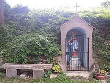
There are several wayside shrines around the place.
Biking and hiking trails
Grünsfeldhausen is located on the 180-kilometer-long Jakobsweg Main-Taubertal . The Grünbachtal cycle path leads from Grünsfeldhausen via Grünsfeld to Gerlachsheim, where there is a connection to the Taubertal cycle path .
traffic
Personalities
literature
- Elmar Weiß: History of the City of Grünsfeld . Hardback edition. 2nd Edition. 654 pages. Grünsfeld: City administration Grünsfeld 1992.
Web links
- Grünsfeldhausen on the website of the city of Grünsfeld
Individual evidence
- ↑ a b City of Grünsfeld: structural data . Online at www.gruensfeld.de. Retrieved January 20, 2016.
- ^ Federal Statistical Office (ed.): Historical municipality directory for the Federal Republic of Germany. Name, border and key number changes in municipalities, counties and administrative districts from May 27, 1970 to December 31, 1982 . W. Kohlhammer, Stuttgart / Mainz 1983, ISBN 3-17-003263-1 , p. 480 .
- ^ Hans Georg Zier, Julius Friedrich Kastner: Book of arms of the district Tauberbischofsheim. Franconian news, Tauberbischofsheim 1967, DNB 458728101 .
- ↑ Population, occupation and workplace censuses in West Germany from June 6, 1961 (municipality register)
- ↑ Population, occupation and workplace censuses in West Germany from May 27, 1970 (municipal register)
- ↑ Updated data from the city of Grünsfeld based on the 2011 census in the European Union (census)
- ^ Federal Statistical Office (ed.): Historical municipality directory for the Federal Republic of Germany. Name, border and key number changes in municipalities, counties and administrative districts from May 27, 1970 to December 31, 1982 . W. Kohlhammer, Stuttgart / Mainz 1983, ISBN 3-17-003263-1 .
- ↑ a b Regional Council Stuttgart: List of architectural and art monuments. Cultural monuments in Grünsfeld. January 13, 2017.
- ↑ Jakobsweg Main-Taubertal (pilgrimage route) - wanderkompass.de. In: wanderkompass.de. Retrieved August 3, 2020 .


