List of cultural monuments in Grünsfeld
|
List of cultural monuments in Weikersheim:
Individual monuments of the core town of Grünsfeld according to street names:
A •
B •
G •
H •
K •
L •
P •
R •
S •
T Individual monuments of the other districts: Grünsfeldhausen • Krensheim • Kützbrunn • Paimar • Zimmer |
The list of cultural monuments in Grünsfeld includes immovable architectural and art monuments from Grünsfeld and its districts. The basis for this list is the list of architectural and art monuments published by the Stuttgart Regional Council as of January 26, 2012. The article is part of the higher-level list of cultural monuments in the Main-Tauber district . This list is not legally binding. Legally binding information is only available on request from the Lower Monument Protection Authority of the city of Grünsfeld.
Small monuments such as wayside shrines, statues and wayside crosses have been preserved in large numbers in the city area. The reason lies in the agricultural structure that has existed since the Middle Ages. In modern times there was no densification of settlement and industry as in the metropolitan areas, so that these cultural monuments were largely preserved in the open air .
Architectural, artistic and cultural monuments in the Grünsfeld district
Grünsfeld (core city)
Architectural, artistic and cultural monuments in Grünsfeld with the core town Grünsfeld ( ⊙ ), the hamlet Hof Uhlberg ( ⊙ ) and the residential areas Am Fessertal ( ⊙ ), industrial park ob der Tauber (Waltersberg) ( ⊙ ), Riedmühle ( ⊙ ), Rötensteinstraße ( ⊙ ) and Wendels (Englerts) -mühle (formerly Neumühle) ( ⊙ ):
Grünsfeld
![]() Map with all coordinates of the cultural monuments in the area of the core city Grünsfeld (without Hof Uhlberg): OSM
Map with all coordinates of the cultural monuments in the area of the core city Grünsfeld (without Hof Uhlberg): OSM
A.
| image | designation | location | Dating | description |
|---|---|---|---|---|
 |
Courtyard, residential house and ornamental half-timbered building | Abt-Wundert-Strasse 4 (map) |
1691 and 1707 | Courtyard area; Residential house, ornamental half-timbered building, 1691 re. with round-arched Franconian courtyard entrance with heraldic wedge stone, 1707 inscribed., and barn, inscribed
|
 |
Arched stone bridge | Am Breiten Steg (map) |
1717 | Arched stone bridge, probably 1717
|
B.
| image | designation | location | Dating | description |
|---|---|---|---|---|
 More pictures |
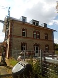
railway station | Bahnhofsweg 4 (map) |
1865 | Railway station on the Baden railway line Lauda-Würzburg. Reception building, two-wing, two-storey solid building in shell limestone with red sandstone structures, gable roof, 1865 re. To the north of it outbuildings
|
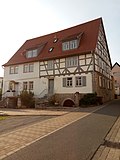 |
Residential building | Bauerngasse 1, 1a (map) |
1700 | Residential building of a former three-sided farmstead, at the cellar arch, re. 1700
|
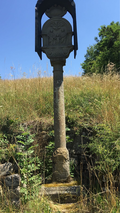 |
Wayside shrine | Besselberger Weg (map) |
Wayside shrine with holy change, 18./19. century
|
|
| Wayside shrine | Brueckle (map) |
2nd half of the 19th century | Wayside shrine with the coronation of Mary, 2nd half of the 19th century
|
G
| image | designation | location | Dating | description |
|---|---|---|---|---|
 |
crossroads | District boundary, L 512 (near) (Distelhausen – Grünsfeld) (map) |
Crossroads on a farm road, right next to a bridge over the L 512 in the direction of Distelhausen. The wayside cross is located on the boundary of Grünsfeld and Tauberbischofsheim-Distelhausen.
|
|
 |
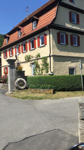
Residential building | Gerlachsheimer Strasse 1, 3 (map) |
around 1900/10 | Residential building. Ornamental half-timbered building with a half-hipped structure, dwarf houses with floating gables, around 1900/10
|
 |
Wendelsmühle | Grünbachstrasse 37 (map) |
1815 | Wendelsmühle. Free-standing plastered building with half-hipped mansard roof, cornice strips and toothed frieze. Rich jewelry portal formerly with skylight, 1815 ins.
|
H
| image | designation | location | Dating | description |
|---|---|---|---|---|
 |
Wayside shrine | Main street (map) |
15./16. century | Crucifixion shrine, 15./16. century
|
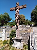 |
crucifix | Hauptstrasse (at the cemetery) (map) |
probably 18th century | Crucifix, marked 1722, Kreuzschlepper, probably 18th century
|
 |
Former residential houses | Hauptstrasse 7, 9 (map) |
before 1500 | Former residential houses. Ground floor new building from 1985 at a modified location with reconstruction of the late Gothic half-timbering (before 1500) on the upper floor and attic
|
 |
Residential building | Hauptstrasse 10 (map) |
1742 | Residential building. Plastered half-timbered building with crooked hip, corner console and round cellar arch. Walled-up garden entrance, wedge stone with cock relief, 1742 ins.
|
 |
town hall | Hauptstrasse 12 (map) |
1579 | Town hall. Rich ornamental half-timbered building from 1579 with older parts.
|
 |
Catholic parish church of St. Peter and Paul | Hauptstrasse 18 (map) |
1659 | Catholic parish church of St. Peter and Paul with a Gothic choir and a baroque nave. Main portal, 1659 re. (Associated equipment in and on the extension).
|
| War memorial in chapel | Hauptstrasse 18 (near) | War memorial First and Second World War. In a chapel attached to the church of St. Peter and Paul, there is a mortuary shrine in the middle, behind it three women and a child as stone sculptures.
On the left of the wall two stone tablets (1st World War), on the right a picture tablet (2nd World War).
|
||
 |
Deportation memorial | Hauptstrasse 18 (near) | Memorial deportation 1940. The memorial for the deported Jewish fellow citizens is in the center of the village in front of the cemetery, between the church and the school. (For details, see inscriptions on the board).
|
|
| War memorial | Hauptstrasse 18 (near) | War memorial. Collective grave. Gravestone in the Grünsfeld cemetery. It stands directly on the old city wall, which separates the cemetery from the area of the adjacent church of St. Peter and Paul. German soldiers who died in the community on April 1, 1945 rest here.
|
||
 |
Wayside shrine | Hauptstraße 18 (near) (map) |
1496 | Traffic light picture stick, 1496 re.
|
 |
Wayside shrine | Hauptstraße 18 (near) (map) |
17./18. century | Wayside shrine with Mary and baby Jesus, 17./18. century
|
 |
City wall, city fortifications, castle substructures with remains of the city wall and city tower | Hauptstrasse 18 (near), Leuchtenbergstrasse, Schloßstrasse, Stadtbrunnenweg (map) |
City wall, city fortifications, castle substructures with remains of the city wall and city tower, medieval
|
|
 |
Former department store | Hauptstrasse 19 (map) |
Former department store, then post office and school building; late classicist building from the early days with natural stone facade
|
|
 |
Vaulted cellar | Hauptstrasse 21 (map) |
around 1400/16. century | Vaulted cellar with mikveh to 1400/16. century
|
 |
Residential building | Hauptstrasse 31 (map) |
Early 19th century | Residential building. Solid construction in corner position with a crooked hip, framed window and door with wedge stones, round cellar arch. Immaculata relief with French inscription. Early 19th century
|
 |
Processional altar | Hauptstrasse 39 (near) (map) |
1627 | Processional altar, 1627 ins. with crucifixion group relief, 1453 ins. and Mount of Olives Group, probably 1627.
|
 |
Marienhaus, now a kindergarten | Hauptstrasse 41 (map) |
1901 | Marienhaus. Solid construction with central projection, floating gable and Madonna niche. 1901 re.
|
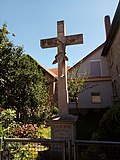 |
crucifix | Hauptstrasse 44 (near) (map) |
1885 | Crucifix, 1885 ins.
|
 |
Wayside shrine | Hermann-Löns-Weg 16 (opposite) (map) |
1716 | Wayside shrine with flagellation of Christ, 1716 ins.
|
K
| image | designation | location | Dating | description |
|---|---|---|---|---|
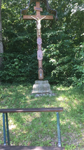 |
Mission cross | Blade (card) |
1852 | Mission cross with gilded Corpus Christi, 1852 ins.
|
 |
Wayside shrine | Krensheimer Strasse, corner of Hauptstrasse (map) |
1637 | Wayside shrine with crucifixion group and donor relief, 1637 ins.
|
 |
Wayside shrine | Krensheimer Strasse (map) |
1702 | Wayside shrine with holy change, 1702 ins
|
 |
Niche group | Krensheimer Strasse 1 (next to the residential building) (map) |
around 1900 | Niche group with Holy Family / Change, around 1900
|
L.
| image | designation | location | Dating | description |
|---|---|---|---|---|
| crucifix | L 512 (an) | 1821 | Crucifix, 1821 ins.
|
|
 |
Wayside shrine | L 512 (an) (card) |
around 1700 | Wayside shrine, around 1700
|
 |
Wayside shrine | Laistraße, Zehntstraße (map) |
17th / 18th century | Wayside shrine with Last Judgment, 17th / 18th century
|
 |
Processional altar | Lange Gasse, corner of Steinbachstrasse (map) |
1698 | Processional altar with Eucharist, 1698 ins.
|
 |
Residential building | Lange Gasse 14, 16 (map) |
16./17. century | Residential building. Plastered half-timbered building with profiled thresholds. 16./17. century
|
 |
Wayside shrine | Lange Gasse 31 (near) (map) |
1646 | Wayside shrine with pietà in auricle style, 1646 ins.
|
 |
Wayside shrine | Leuchtenbergstrasse | 1739 | Wayside shrine with Walldürner blood count, 1739 ins.
|
 |
Wayside shrine | Leuchtenbergstrasse, corner of Schorrenweg (map) |
1600 | Wayside shrine housing, 1600 re.
|
 |
Wayside shrine | Leuchtenbergstrasse 23 (opposite) (map) |
1762 | Wayside shrine, Christ carrying the cross, relief attachment above column, shell limestone, 1762 ins.
|
P
| image | designation | location | Dating | description |
|---|---|---|---|---|
 |
Drilled portal | Pfarrgasse 7 (at the residential building) (map) |
1793 | Drilled portal, marked 1735, and Franconian courtyard arch, 1793 marked.
|
R.
| image | designation | location | Dating | description |
|---|---|---|---|---|
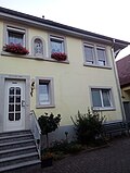 |
Residential building | Rieneckstrasse 9 (map) |
16th Century | Residential building. Plastered building with a profiled pointed arch portal, 16th century
|
 |
Processional altar | Ringstrasse, corner of Leuchtenbergstrasse (map) |
1704 | Processional altar with Eucharist, 1704 ins.
|
 |
Processional altar | Ringstrasse (map) |
1698 | Processional altar with Eucharist, 1698 ins.
|
| Wayside shrine | Rötensteinstrasse (map) |
Wayside shrine
|
||
 |
Wayside shrine | Rötensteinstrasse (map) |
1623 | Wayside shrine housing, 1623 re.
|
S.
| image | designation | location | Dating | description |
|---|---|---|---|---|
 |
Residential building, so-called office building | Schloßstraße 7, 9 (map) |
16./19. century |
Residential building (No. 7), 16./19. Century and office building also known as the cellar building (No. 9). Ornamental half-timbered building, 1668 inscribed, Franconian courtyard archway with grimacing head wedge, 1691 inscribed. Houses a museum.
|
 |
Tenth building | Schloßstraße 15, 17, 19, 21 (map) |
1482 | Tenth building. Solid construction with stepped gable and cripple hip over a large vaulted cellar. 1482 re., Rebuilt in 1631
|
 |
Tithe barn | Schloßstraße 20, 22 (map) |
1799 | Tithe barn. Solid construction with half-hip and segment-arched gates. 1799
|
 |
City fountain system | Stadtbrunnenweg (map) |
1704 | City fountain system. Remains of the town wall with a memorial stone to the flood of 1704.
|
 More pictures |
Stations of the Cross | Station path (map) |
1856 |
Grünsfelder Kreuzweg , Freilandkreuzweg, with 14 stations of the cross made of red sandstone. 1856 by Th. Pfeiffer.
|
 More pictures |
1st station of the cross | Station path | 1856 | 1st station of the cross. I. Jesus is condemned by Pilate.
|
 More pictures |
2nd station of the cross | Station path | 1856 | 2nd station of the cross. II. Jesus takes the heavy cross on his shoulder.
|
 More pictures |
3rd station of the cross | Station path | 1856 | 3rd station of the cross. III. Jesus falls under the cross for the first time.
|
 More pictures |
4th station of the cross | Station path | 1856 | 4th station of the cross. IV. Jesus meets his holy mother.
|
 More pictures |
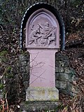
5th station of the cross | Station path | 1856 | 5th station of the cross. V. Simon helps Jesus carry the cross.
|
 More pictures |
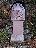
6. Stations of the Cross | Station path | 1856 | 6. Stations of the Cross. VI. Veronica hands the handkerchief to Jesus.
|
 More pictures |
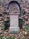
7th station of the cross | Station path | 1856 | 7th station of the cross. VII. Jesus falls under the cross for the second time.
|
 More pictures |
8. Station of the Cross | Station path | 1856 | 8. Station of the Cross. VIII. Jesus meets the weeping daughters of Jerusalem.
|
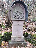 More pictures |
9. Stations of the Cross | Station path | 1856 | 9. Stations of the Cross. IX. Jesus falls under the cross for the third time.
|
 More pictures |
10th station of the cross | Station path | 1856 | 10th station of the cross. X. Jesus is stripped of his clothes.
|
 More pictures |
11. Stations of the Cross | Station path | 1856 | 11. Stations of the Cross. XI. Jesus is nailed to the cross.
|
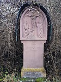 More pictures |
12. Stations of the Cross | Station path | 1856 | 12. Stations of the Cross. XII. Jesus dies on the cross.
|
 More pictures |
13. Stations of the Cross | Station path | 1856 | 13. Stations of the Cross. XIII. Jesus is taken down from the cross.
|
 More pictures |
14. Station of the Cross | Station path | 1856 | 14. Station of the Cross. XIV. Jesus is laid in the grave.
|
 |
Wayside shrine | Station path (map) |
|
|
 |
Eisner's mill | Steinbachstrasse 9 (map) |
1806 | Eisner's mill. Solid construction with half-hipped mansard roof, round cellar arch. Wedge stone with half wheel, 1806 ins.
|
 |
Cross group | Steinbachstraße 11 (near) (map) |
1718 | Kreuzgruppe, 1718 ins.
|
 |
Garden posts | Steinbachstrasse 11 (opposite) (map) |
1791 | Garden post with pine cones, 1791 inscribed.
|
T
| image | designation | location | Dating | description |
|---|---|---|---|---|
 |
sculpture | Taubertalstrasse (map) |
1943 ff. | Sculpture Strong Heinrich , 1943ff.
|
 |
Echquader with head relief | Stairway 1 (by the building) (map) |
probably 16th century | Echquader with head relief, probably 16th century
|
Uhlberg farm
Architectural, art and cultural monuments in Hof Uhlberg ( ⊙ ):
![]() Map with all the coordinates of the cultural monuments of the hamlet of Hof Uhlberg (on the district of the core town Grünsfeld): OSM
Map with all the coordinates of the cultural monuments of the hamlet of Hof Uhlberg (on the district of the core town Grünsfeld): OSM
| image | designation | location | Dating | description |
|---|---|---|---|---|
 |
Wayside shrine | Hof Uhlberg, Flst. No. 0-10681 (card) |
1729 | Trinity shrine with a vine-entwined column (Uhlberg courtyard)
|
 |
Wayside shrine | Hof Uhlberg, Bodenäcker (map) |
18th century | Pietà, 18th century (Hof Uhlberg)
|
 |
Homestead | Hof Uhlberg 1 (map) |
1853 | Homestead. Solid construction with half hip (Hof Uhlberg):
|
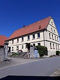 |
Sliding stone window | Hof Uhlberg 5 (map) |
1835 | Sliding stone windows and courtyard gate pillars (Uhlberg courtyard):
|
 |
chapel | Hof Uhlberg 9 (map) |
1886 |
Marienkapelle (Hof Uhlberg). Chapel. Rectangular construction with roof turrets and polygonal closure, 1886 re.
|
Grünsfeldhausen
Architectural, art and cultural monuments in Grünsfeldhausen ( ⊙ ):
![]() Map with all the coordinates of the cultural monuments in the district of Grünsfeldhausen: OSM
Map with all the coordinates of the cultural monuments in the district of Grünsfeldhausen: OSM
| image | designation | location | Dating | description |
|---|---|---|---|---|
| Stone cross | Ash furrow | 1907 | Hall cross with body on inscription base, sandstone, 1907 ins.
|
|
 |
building | Frankenweg 6 (map) |
1800 | Former school house, today residential building, around 1800
|
| War memorial | graveyard | War memorial First and Second World War. The war memorial is located in the cemetery. A stone-clad wall with stone nameplates inserted. In the middle a dying scene with dates and a thorn tendril.
|
||
| Atonement Cross | Wooden picture | Atonement cross, medieval
|
||
 |
sculpture | Kapellenstrasse (map) |
1807 | Mother of God sculpture, 1807 ins.
|
 |
St. Achatius | Kapellenstrasse 1 (map) |
1200 | Catholic Chapel of St. Achatius . Octagonal central building, around 1200.
|
 |
Wayside shrine | Krensheimer Steige (map) |
1600 | Wayside shrine housing, 1600 re.
|
| Wayside shrine | Folks | 16/17. century | Wayside shrine with group of cross. Cross relief in the pillar, 16./17. century
|
|
 |
statue | Mühlenstrasse (map) |
1739 | Nepomuk statue on pedestal with chronogram , 1739 ins.
|
 |
building | Mühlenstrasse 1 (map) |
1872 | Mill building, mill with cellar house, on Keilstein bez. 1872
|
Krensheim
Architectural, art and cultural monuments in Krensheim ( ⊙ ):
![]() Map with all coordinates of the cultural monuments in the district of Krensheim: OSM
Map with all coordinates of the cultural monuments in the district of Krensheim: OSM
| image | designation | location | Dating | description |
|---|---|---|---|---|
| Wayside shrine | Left at Schönfelder Weg (Gewann) | probably 16th century | Wayside shrine housing (Krensheim)
|
|
| Wayside shrine | External Shortening (Won) | 19th century | Wayside shrine with 14 helpers (Krensheim)
|
|
| Wayside shrine | At the old well 1 (opposite) | 1705 | Wayside shrine with Pietà (Krensheim)
|
|
| crucifix | Eichelsee left (opposite) | 1885 | Crucifix (Krensheim)
|
|
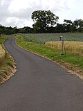 More pictures |
Stations of the Cross | Gereut, Wittighäuser Weg (am) (map) |
around 1900 | Cast iron stations of the cross (Krensheim). 14 stations of the cross.
|
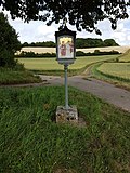 More pictures |
1st station of the cross | Gereut, Wittighäuser Weg (am) | around 1900 | 1st station of the cross. I. Jesus is sentenced to death.
|
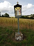 More pictures |
2nd station of the cross | Gereut, Wittighäuser Weg (am) | around 1900 | 2nd station of the cross. II. Jesus takes up the cross.
|
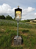 More pictures |
3rd station of the cross | Gereut, Wittighäuser Weg (am) | around 1900 | 3rd station of the cross. III. Jesus falls for the first time.
|
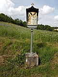 More pictures |
4th station of the cross | Gereut, Wittighäuser Weg (am) | around 1900 | 4th station of the cross. IV. Jesus meets his sad mother.
|
 More pictures |
5th station of the cross | Gereut, Wittighäuser Weg (am) | around 1900 | 5th station of the cross. V. Sim. V. Cyrene helps Jesus carry the cross.
|
 More pictures |
6. Stations of the Cross | Gereut, Wittighäuser Weg (am) | around 1900 | 6. Stations of the Cross. VI. Veronica gives Jesus the handkerchief.
|
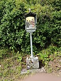 More pictures |
7th station of the cross | Gereut, Wittighäuser Weg (am) | around 1900 | 7th station of the cross. VII. Jesus falls the second time.
|
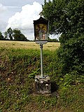 More pictures |
8. Station of the Cross | Gereut, Wittighäuser Weg (am) | around 1900 | 8. Station of the Cross. VIII. Jesus speaking to the weeping women.
|
 More pictures |
9. Stations of the Cross | Gereut, Wittighäuser Weg (am) | around 1900 | 9. Stations of the Cross. IX. Jesus falls the third time.
|
 More pictures |
10th station of the cross | Gereut, Wittighäuser Weg (am) | around 1900 | 10th station of the cross. X. Jesus is stripped of his clothes.
|
 More pictures |
11. Stations of the Cross | Gereut, Wittighäuser Weg (am) | around 1900 | 11. Stations of the Cross. XI. Jesus is nailed to the cross.
|
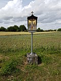 More pictures |
12. Stations of the Cross | Gereut, Wittighäuser Weg (am) | around 1900 | 12. Stations of the Cross. XII. Jesus dies on the cross.
|
 More pictures |
13. Stations of the Cross | Gereut, Wittighäuser Weg (am) | around 1900 | 13. Stations of the Cross. XIII. Jesus is taken down from the cross.
|
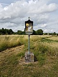 More pictures |
14. Station of the Cross | Gereut, Wittighäuser Weg (am) | around 1900 | 14. Station of the Cross. XIV. Jesus is laid in the grave.
|
| crucifix | Ilmspaner Weg (am) (map) |
1872 | Crucifix (Krensheim)
|
|
| Solid building in a corner location that defines the townscape | Mittlere Strasse 2 (map) |
1904 | White Horse Inn. Solid building that defines the townscape in a corner position, window frames in relief, corner blocks, portal with vestibule, courtyard gate pillar with pine cones (Krensheim)
|
|
| Cast iron pump with stone trough | Mittlere Strasse 14 (next to) (map) |
19th century | Cast iron pump with stone trough (Krensheim)
|
|
| Wayside shrine | New street | 17./18. century | Wayside shrine housing (Krensheim)
|
|
| Wayside shrine | Neue Straße 11 (next to) (map) |
16th Century | Wayside shrine with crucifixion
|
|
| Wayside shrine | Neue Straße 13 (before) | 1868 | Wayside shrine with the Coronation of Mary, 1868 ins.
|
|
| Residential building | Neue Strasse 19 (map) |
1875 | Solid construction with half hip, corner blocks and cornices. Holy niche. Neo-Gothic portal with vestibule on the side, 1875 ins.
|
|
| Residential building | Neue Strasse 25 (map) |
Solid construction with a half-hip roof. Stone tablets with coats of arms IHS, MW and AS, 1833 ins.
|
||
| Cross tug | Neue Strasse 28 (opposite) | 1710 | Kreuzschlepper, 1710 re.
|
|
| crucifix | Puddle fields (won) | 1856 | Wayside shrine with 14 helpers (Krensheim)
|
|
| Wayside shrine | Grinding path (won) | 1901 | Wayside shrine with Holy Family / Change (Krensheim)
|
|
| Marian column | Seestrasse | 1892 | Marian column, inscribed in 1892, figure newer
|
|
| Wayside shrine | Seestrasse | 1777 | Wayside shrine housing, 1777 re.
|
|
| Residential building | Seestrasse 12 (map) |
1857 | Residential building. Solid construction with half hip, corner blocks and cornices; two holy niches and panels, 1857 ins.
|
|
| town hall | Seestrasse 16 (map) |
1st half of the 19th century | Town hall. Solid construction with half hip and round cellar arch. 1st half of the 19th century
|
|
 |
Catholic parish church | Seestrasse 18 (map) |
1753 | Catholic parish church of St. Giles . Hall building with entrance tower and polygonal choir. 1753 supposedly by B. Neumann.
|
| crucifix | Seestrasse 18 (near) | probably 18th century | Crucifix, inscribed in 1806, and wayside shrine with Pietà, probably 18th century
|
|
| War memorial | Seestrasse 18 (near) | War memorial First and Second World War. The war memorial in front of the church.
In the middle there is a wayside shrine, to the right and left of it there are stone name plaques on a wall.
|
||
| Residential building | Seestrasse 26 (map) |
1835 | Residential building. Solid construction with a half-hip roof. Cross relief and panels with coat of arms, IHS PD, 1835 ins.
|
|
| Wayside shrine | Road to Grünsfeld | 1618 | Wayside shrine housing, 1618 re.
|
|
| Wayside shrine | Road to Grünsfeld | probably 18th century | Wayside shrine with Ecce Homo
|
|
| Saint sculpture | Road to Unterwittighausen | around 1900 | Saint sculpture
|
|
| Mary figure | Uhlberger Weg (am) | 1902 | Marienfigur (Krensheim)
|
|
| Christ figure | Uhlberger Weg (am) | Christ figure (Krensheim)
|
Kützbrunn
Architectural, art and cultural monuments in Kützbrunn ( ⊙ ):
![]() Map with all the coordinates of the cultural monuments in the Kützbrunn district: OSM
Map with all the coordinates of the cultural monuments in the Kützbrunn district: OSM
| image | designation | location | Dating | description |
|---|---|---|---|---|
 |
Double shrine | Frankenstrasse, Fichtenweg (map) |
1877 | Double shrine with Pietà and 14 helpers in need, 1877 ins.
|
 |
Catholic parish church | Frankenstrasse 2 (map) |
1735 | Catholic Parish Church of the Holy Trinity (lat. Ad Sanctissimam Trinitatem ). Baroque hall building with a polygonal finish, 1735, extended in 1959, and a free-standing tower from 1956.
|
| War memorial | Frankenstrasse 2 | War memorial First and Second World War. On the outside of the Holy Trinity Church is the war memorial. A plaque made of black marble. In the middle an inscription and an outline of a steel helmet with oak leaves and a side gun underlaid.
|
||
 |
crucifix | Frankenstrasse 2 (behind) | Crucifix in the cemetery, 1820 ins.
|
|
 |
Wayside shrine | Frankenstraße 19 (before) (map) |
19th century | Wayside shrine altar with 14 helpers, 19th century
|
| Wayside shrine | Gemeindegärtle (Won) | probably around 1800 | Wayside shrine, probably around 1800, rebuilt in 1953
|
|
 |
Aviator grave | K 2803 (Zimmer – Kützbrunn) |
Aviator's grave , located in a forest on the edge of the K 2803
|
|
 |
chapel | Kirchenäcker (Gewann), Frankenstrasse (map) |
probably early 20th century |
Lourdes grotto chapel , probably early 20th century
|
| Wayside shrine | Oberholz (Won) | 1889 | Wayside shrine with Pietà, neo-Gothic, 1889 ins.
|
|
 |
Wayside shrine | Stutzäcker (Gewann), near Vockenberg | 1796 | Wayside shrine housing, 1796 ins.
|
Paimar
Architectural, artistic and cultural monuments in Paimar ( ⊙ ):
![]() Map with all coordinates of the cultural monuments in the district of Paimar: OSM
Map with all coordinates of the cultural monuments in the district of Paimar: OSM
| image | designation | location | Dating | description |
|---|---|---|---|---|
 |
Wayside shrine | On the middle way (Won) | 1798 | Wayside shrine housing, 1798 re.
|
 |
crucifix | On the middle way (Won) | 1900 | Crucifix, 1900 ins.
|
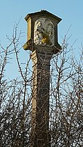 |
Wayside shrine | On the Steig (Won) | 19th century | Trinity shrine, 19th century
|
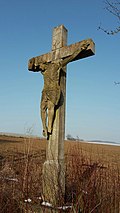 |
crucifix | On the Steig (Won) | crucifix
|
|
 |
Wayside shrine | Bischofsheimer Strasse 5 (map) |
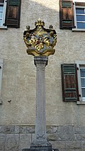
1794 | Wayside shrine with the Coronation of Mary, inscribed in 1794, next to Bischofsheimer Straße 5
|
| War memorial | graveyard | War memorial. In the front of the funeral hall hangs a wooden cross, next to it two stone tablets.
|
||
| War memorial | graveyard | War memorial. In the cemetery there is a stone cross with a figure, next to it a stone cube.
|
||
 |
crucifix | Cross (won) | crucifix
|
|
 |
Wayside shrine | Krensheimer Strasse (map) |
18th century | Wayside shrine case, 18th century, located on Krensheimer Strasse
|
 |
Lindenstrasse 22 (map) |
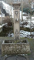
19th century | Cast iron water stick, 19th century, opposite Lindenstrasse 22
|
|
 More pictures |
St. Laurence | Lindenstrasse 24 (map) |
1829 | Catholic parish church St. Laurentius, 1829 re.
|
 |
Cemetery cross | Lindenstrasse 24 (map) |
1818 | Cemetery cross on the former cemetery, marked 1818, at Lindenstrasse 24
|
Rooms
Architectural, artistic and cultural monuments in rooms ( ⊙ ):
![]() Map with all the coordinates of the cultural monuments in the district of Zimmer: OSM
Map with all the coordinates of the cultural monuments in the district of Zimmer: OSM
| image | designation | location | Dating | description |
|---|---|---|---|---|
 |
ruin | Bickelsgasse (map) |
probably 17th century | Ruin of the former tithe barn, probably 17th century. Enclosing walls made of quarry stones with corner blocks and a gate opening facing Bickelsgasse, as well as the remainder of an oculus to the right above the door opening
|
 |
relief | Bickelsgasse 3 (map) |
probably 16./17. century | Relief of a crucified, probably 16./17. century
|
 |
Lourdes Chapel | Friedhofsweg 18 (map) |
1898 | Lourdes Chapel. Gable-mounted, barrel-vaulted solid building from 1898. As a result of the apparitions of Mary in Lourdes (France) in 1858, a grotto was built in many places as a religious impression, always in the style of the Lourdes grotto with a replica of the local figure of Mary. This is also the case in Zimmer: This was built in the immediate vicinity of the cemetery in 1898 as a joint effort by many people from Zimmer and under the direction of master mason Heck.
|
| War memorial | Friedhofsweg | War memorial First and Second World War. The war memorial is in the cemetery.
A stone cross, next to it a memorial stone.
|
||
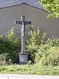 |
Wayside shrine | Grünsfelder Strasse 3 (before) (map) |
1619 | Wayside shrine with crucifixion, inscribed on pillars 1619
|
 |
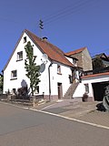
Courtyard and double dwelling | Grünsfelder Strasse 12 (map) |
Early 19th century | Courtyard. Semi-detached house, solid, two-storey, corner pilaster, window frame with wedge stone, crooked hip roof, vaulted cellar, early 19th century and barn with cellar, solid ground floor, upper floor half-timbered, solid gable against the residential building, crooked hip roof
|
 |
Wayside shrine | Grünsfelder Straße 13 (opposite) (map) |
1798 | Wayside shrine with the Coronation of Mary, 1798 ins.
|
 |
Former school and town hall | Grünsfelder Strasse 22 (map) |
1877 | Former school and town hall. Two-storey solid limestone building with red sandstone inclusions, central projectile and hipped roof. 1877 re.
|
 |
Double shrine | Gewann Hüttenäcker / K 2803 (map) |
1901 | Double shrine. Pietà and Trinity, 1901
|
| Wayside shrine | Reuterspfad, Vilchbander Straße / K 2804 | 1708 | Wayside shrine with Pietà, 1708 ins.
|
|
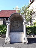 |
Processional altar | Kirchgasse 2 (next to) (map) |
1797 | Processional altar with relief of a coronation of Mary, 1797 ins.
|
 |
Catholic parish church St. Margaretha | Kirchgasse 4 (map) |
1768 | Catholic parish church St. Margaretha . Hall building with polygonal choir and entrance tower, 1768 by Johann Michael Fischer from Würzburg.
|
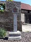 |
Wayside shrine | Kirchgasse 4 (near) (map) |
18th century | Wayside shrine made of red sandstone. Immaculata with Christ child on a winding column, 18th century
|
 |
Catholic rectory | Kirchgasse 6 (map) |
1809/10 | Catholic parsonage, consisting of a parsonage from 1809/10, a plastered, essentially massive building, and an older wooden frame, a timber-framed building over a vaulted cellar with access to the gable side, belonging to it: a parish garden with a parish garden wall made of irregular limestone blocks
|
 More pictures |
Station reception building | Lagerhausstrasse 4 (map) |
1865 | Station reception building, two-storey main building with a one-storey extension in the east, plastered building with corner blocks, cornices and door and window frames made of red sandstone, 1865 (Badische Odenwaldbahn)
|
 |
Processional altar | Obere Gasse 2 (next to), corner of Bickelsgasse (map) |
1764 | Processional altar with Trinity, 1764 ins.
|
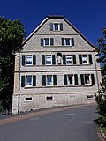 |
Homestead | Untere Gasse 2 (map) |
1854/55 | Homestead from 1854/55. Residential building. Solid construction with half-hipped roof, square corner pilasters, cornice strips and round cellar arch, at the side entrance coat of arms and the year 1855 and massive double barn, KLM 1854 inscribed.
|
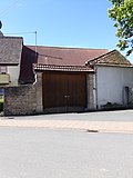 |
Gate system, solid construction | Untere Gasse 4 (map) |
1859 | Gate system, solid construction. 1859 re. with an adjoining shell limestone wall
|
 |
Wayside shrine | Untere Gasse 5 (at) (map) |
1869 | Wayside shrine housing, 1869 re
|
| crucifix | Vilchbander Strasse / K 2804 (map) |
1908 | Crucifix, 1908 ins.
|
|
| Wayside shrine | Vorstadtstrasse 4 (map) |
1687 | Part of a wayside shrine, built into the street facade of the house, 1687 re.
|
See also
- List of cultural monuments in the Main-Tauber district
- List of war memorials in Grünsfeld
- List of street names in Grünsfeld , where many of the cultural monuments are located
Web links
Remarks
- ↑ This list may not correspond to the current status of the official list of monuments. This can be viewed by the responsible authorities. Therefore, the presence or absence of a structure or ensemble on this list does not guarantee that it is or is not a registered monument at the present time. The State Office for Monument Preservation Baden-Württemberg provides binding information .
Individual evidence
- ↑ Rathaus Hauptstrasse 12 Grünsfeld - detail page - LEO-BW. In: leo-bw.de. Retrieved May 20, 2020 .
- ↑ St Peter and Paul Hauptstrasse 18 Grünsfeld - detail page - LEO-BW. In: leo-bw.de. Retrieved May 20, 2020 .
- ^ Grünsfeld, Main-Tauber-Kreis, Baden-Württemberg. In: denkmalprojekt.org. Retrieved May 20, 2020 .
- ↑ Memorial Deportation 1940 97947 Grünsfeld, Main-Tauber-Kreis, Baden-Württemberg. In: denkmalprojekt.org. Retrieved May 20, 2020 .
- ^ Grünsfeld (collective grave), Main-Tauber district, Baden-Württemberg. In: denkmalprojekt.org. Retrieved May 20, 2020 .
- ↑ Altar at Hauptstrasse 39 near Grünsfeld - detail page - LEO-BW. In: leo-bw.de. Retrieved May 20, 2020 .
- ↑ Kindergarten Hauptstrasse 41 Grünsfeld - detail page - LEO-BW. In: leo-bw.de. Retrieved May 20, 2020 .
- ^ Museum im Amtshaus - detail page - LEO-BW. In: leo-bw.de. Retrieved May 20, 2020 .
- ↑ Kapelle Hof Uhlberg 9 Grünsfeld - detail page - LEO-BW. In: leo-bw.de. Retrieved May 20, 2020 .
- ^ Grünsfeldhausen, City of Grünsfeld, Main-Tauber District, Baden-Württemberg. In: denkmalprojekt.org. Retrieved May 20, 2020 .
- ↑ St Achatius Kapellenstrasse 1 Grünsfeld - detail page - LEO-BW. In: leo-bw.de. Retrieved May 20, 2020 .
- ↑ Good start for new community team. In: mainpost.de. Retrieved May 20, 2020 .
- ↑ Church Seestraße 18 Grünsfeld - detail page - LEO-BW. In: leo-bw.de. Retrieved May 20, 2020 .
- ^ Krensheim, City of Grünsfeld, Main-Tauber District, Baden-Württemberg. In: denkmalprojekt.org. Retrieved May 20, 2020 .
- ↑ Ad Sanctissimam Trinitatem Frankenstrasse 2 Grünsfeld - detail page - LEO-BW. In: leo-bw.de. Retrieved May 20, 2020 .
- ^ Kützbrunn, City of Grünsfeld, Main-Tauber District, Baden-Württemberg. In: denkmalprojekt.org. Retrieved May 20, 2020 .
- ^ Chapel Frankenstrasse Grünsfeld - detail page - LEO-BW. In: leo-bw.de. Retrieved May 20, 2020 .
- ^ A b Paimar, City of Grünsfeld, Main-Tauber District, Baden-Württemberg. In: denkmalprojekt.org. Retrieved May 20, 2020 .
- ↑ St Laurentius Lindenstrasse 24 Grünsfeld - detail page - LEO-BW. In: leo-bw.de. Retrieved May 20, 2020 .
- ↑ Lourdes grotto city Grünsfeld. In: gruensfeld.de. Retrieved May 20, 2020 .
- ↑ Chapel Friedhofsweg 18 Grünsfeld - detail page - LEO-BW. In: leo-bw.de. Retrieved May 20, 2020 .
- ^ Zimmer, City of Grünsfeld, Main-Tauber District, Baden-Württemberg. In: denkmalprojekt.org. Retrieved May 20, 2020 .
- ↑ School and town hall Grünsfelder Straße 22 Grünsfeld - detail page - LEO-BW. In: leo-bw.de. Retrieved May 20, 2020 .
- ↑ St Margareta Kirchgasse 4 Grünsfeld - detail page - LEO-BW. In: leo-bw.de. Retrieved May 20, 2020 .
